Calaveras Lake fishing map is available as part of iBoating : USA Marine & Fishing App(now supported on multiple platforms including Android, iPhone/iPad, MacBook, and Windows(tablet and phone)/PC based chartplotter.).
With our Lake Maps App, you get all the great marine chart app features like fishing spots, along with Calaveras Lake depth map. The fishing maps app include HD lake depth contours, along with advanced features found in Fish Finder / Gps Chart Plotter systems, turning your device into a Depth Finder. The Calaveras Lake Navigation App provides advanced features of a Marine Chartplotter including adjusting water level offset and custom depth shading. Fishing spots and depth contours layers are available in most Lake maps. Lake navigation features include advanced instrumentation to gather wind speed direction, water temperature, water depth, and accurate GPS with AIS receivers(using NMEA over TCP/UDP). Autopilot support can be enabled during ‘Goto WayPoint’ and ‘Route Assistance’.
Now i-Boating supports Fishing Points in Calaveras Lake.
Have more questions about the Nautical Chart App? Ask us.
Fishing Info for Calaveras Lake
Calaveras Lake is a reservoir on Calaveras Creek, located 20 miles (32 kilometers) southeast of Downtown San Antonio, Texas, USA. The reservoir was formed in 1969 by the construction of a dam to provide a cooling pond for a series of power plants, called the Calaveras Power Station, to supply additional electricity to the city of San Antonio. The dam and lake are managed by CPS Energy of San Antonio. Together with the smaller Victor Braunig Lake, Calaveras Lake was one of the first projects in the nation to use treated wastewater for power plant cooling. The reservoir is partly filled with wastewater that has undergone both primary and secondary treatment at a San Antonio Water System treatment plant. Calaveras Lake also serves as a venue for recreation, including fishing and boating. Sailboats are prohibited on the lake.
More on Wikipedia...Popular fish species in this lake include Largemouth bass and Red drum.
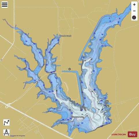
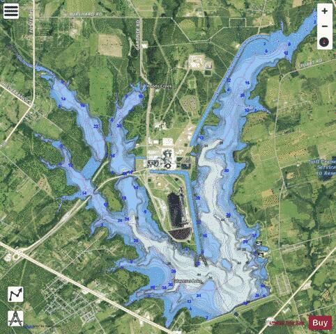
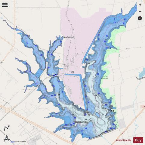
Calaveras Lake Fishing Map Stats | |
| Title | Calaveras Lake |
| Scale | 1:24000 |
| Counties | Bexar |
| Nearby Cities | Elmendorf, China Grove, Southton, Saint Hedwig, Kirby, Earle, San Antonio, La Vernia, Terrell Hills, Thelma |
| Area * | 3223.20 acres |
| Shoreline * | 50.43 miles |
| Min Longitude | -98.36 |
| Min Latitude | 29.28 |
| Max Longitude | -98.28 |
| Max Latitude | 29.34 |
| Edition Label 1 | |
| Edition Label 2 | |
| Edition Label 3 | |
| Id | US_UB_TX_01353532 |
| Country | US |
| Projection | Mercator |
| * some Stats may include nearby/connecting waterbodies | |
|