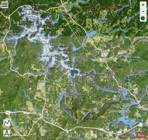
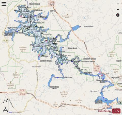
Nottely Lake fishing map is available as part of iBoating : USA Marine & Fishing App(now supported on multiple platforms including Android, iPhone/iPad, MacBook, and Windows(tablet and phone)/PC based chartplotter.).
With our Lake Maps App, you get all the great marine chart app features like fishing spots, along with Nottely Lake depth map. The fishing maps app include HD lake depth contours, along with advanced features found in Fish Finder / Gps Chart Plotter systems, turning your device into a Depth Finder. The Nottely Lake Navigation App provides advanced features of a Marine Chartplotter including adjusting water level offset and custom depth shading. Fishing spots and depth contours layers are available in most Lake maps. Lake navigation features include advanced instrumentation to gather wind speed direction, water temperature, water depth, and accurate GPS with AIS receivers(using NMEA over TCP/UDP). Autopilot support can be enabled during ‘Goto WayPoint’ and ‘Route Assistance’.
Now i-Boating supports Fishing Points in Nottely Lake.
Have more questions about the Nautical Chart App? Ask us.
Fishing Info for Nottely Lake
Lake Nottely (also called Nottely Reservoir) is one of many reservoirs of the Tennessee Valley Authority. It is located entirely in Union County, Georgia in the United States and within the Chatahoochee-Oconee National Forests. Formed in 1942 by the damming of the Nottely River, Nottely Reservoir extends 20 miles (30 km) upstream to the town of Blairsville. Construction of Nottely Dam began in 1941 and was completed in 1942. The dam is 184 feet (56 m) high and stretches 2,300 feet (701 m) across the Nottely River. Lake Nottely is approximately 20 miles (32 km) long and 102 feet (31 m) wide as well as an average depth of 10.6 metres (35 ft), a max depth of 98 feet (30 m) at the dam, and has a flood-storage capacity of 61,588 acre-feet (75,968,000 m3). Its primary purpose was for flood control in the Tennessee River watershed, but in the 1950s a single 15 megawatt generator was installed for power generation. Approximately 70% of the shoreline is under the jurisdiction of the United States Forest Service and undeveloped. In recent years, many new homes and properties have contributed to Lake Nottely's growing importance for recreation. Its proximity to Atlanta (2 hours) is resulting in increased use of this reservoir.
More on Wikipedia...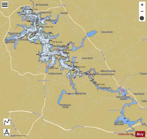
Nottely Lake Fishing Map Stats | |
| Title | Nottely Lake |
| Scale | 1:12000 |
| Counties | Union |
| Nearby Cities | Blairsville, Culberson, Brasstown, Murphy, Young Harris, Morganton, Mineral Bluff, Hiwassee, Blue Ridge, Hayesville |
| Area * | 3610.48 acres |
| Shoreline * | 86.06 miles |
| Min Longitude | -84.12 |
| Min Latitude | 34.86 |
| Max Longitude | -83.98 |
| Max Latitude | 34.96 |
| Edition Label 1 | |
| Edition Label 2 | |
| Edition Label 3 | |
| Id | US_UB_GA_00329068 |
| Country | US |
| Projection | Mercator |
| * some Stats may include nearby/connecting waterbodies | |
|