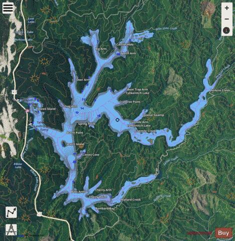
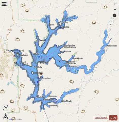
Tahkenitch Lake fishing map is available as part of iBoating : USA Marine & Fishing App(now supported on multiple platforms including Android, iPhone/iPad, MacBook, and Windows(tablet and phone)/PC based chartplotter.).
With our Lake Maps App, you get all the great marine chart app features like fishing spots, along with Tahkenitch Lake depth map. The fishing maps app include HD lake depth contours, along with advanced features found in Fish Finder / Gps Chart Plotter systems, turning your device into a Depth Finder. The Tahkenitch Lake Navigation App provides advanced features of a Marine Chartplotter including adjusting water level offset and custom depth shading. Fishing spots and depth contours layers are available in most Lake maps. Lake navigation features include advanced instrumentation to gather wind speed direction, water temperature, water depth, and accurate GPS with AIS receivers(using NMEA over TCP/UDP). Autopilot support can be enabled during ‘Goto WayPoint’ and ‘Route Assistance’.
Now i-Boating supports Fishing Points in Tahkenitch Lake.
Have more questions about the Nautical Chart App? Ask us.
Fishing Info for Tahkenitch Lake
Tahkenitch Lake (tak' ə nich), at 2,118 acres (857 ha), is one of the larger lakes along the coast of the U.S. state of Oregon. Fed by runoff from a basin of about 34 square miles (88 km2), it lies east of U.S. Route 101 in Douglas County between Florence and Reedsport. Its name comes from a Lower Umpqua (Siuslaw) placename meaning "having arms running out like a crab".
More on Wikipedia...Popular fish species in this lake include Largemouth bass, Rainbow trout, Smallmouth bass and Yellow perch.
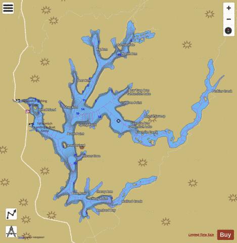
Tahkenitch Lake Fishing Map Stats | |
| Title | Tahkenitch Lake |
| Scale | 1:6000 |
| Counties | Douglas |
| Nearby Cities | Gardiner, Dunes City, Siltcoos, Reedsport, Winchester Bay, Florence, Cushman, Lakeside, Hauser, Scottsburg |
| Area * | 2118.72 acres |
| Shoreline * | 48.93 miles |
| Min Longitude | -124.15 |
| Min Latitude | 43.77 |
| Max Longitude | -124.06 |
| Max Latitude | 43.83 |
| Edition Label 1 | |
| Edition Label 2 | |
| Edition Label 3 | |
| Id | US_OR_ordfw_tahkenitch_lake |
| Country | US |
| Projection | Mercator |
| * some Stats may include nearby/connecting waterbodies | |
|