Lake Hefner fishing map is available as part of iBoating : USA Marine & Fishing App(now supported on multiple platforms including Android, iPhone/iPad, MacBook, and Windows(tablet and phone)/PC based chartplotter.).
With our Lake Maps App, you get all the great marine chart app features like fishing spots, along with Lake Hefner depth map. The fishing maps app include HD lake depth contours, along with advanced features found in Fish Finder / Gps Chart Plotter systems, turning your device into a Depth Finder. The Lake Hefner Navigation App provides advanced features of a Marine Chartplotter including adjusting water level offset and custom depth shading. Fishing spots and depth contours layers are available in most Lake maps. Lake navigation features include advanced instrumentation to gather wind speed direction, water temperature, water depth, and accurate GPS with AIS receivers(using NMEA over TCP/UDP). Autopilot support can be enabled during ‘Goto WayPoint’ and ‘Route Assistance’.
Now i-Boating supports Fishing Points in Lake Hefner.
Have more questions about the Nautical Chart App? Ask us.
Fishing Info for Lake Hefner
Lake Hefner is a reservoir in northwestern Oklahoma City, Oklahoma. It was built in the 1940's to expand the water supply for the city of Oklahoma City, in part through the labor of German POW's. It is named after Robert A. Hefner, who served as mayor of Oklahoma City from April 11, 1939 to April 8, 1947, but was originally named the "Bluff Creek Reservoir." It also serves as a major recreational destination, as it is surrounded by 9.5 miles (15.3 km) of multi-use (bicycle, skating and pedestrian) trails.
More on Wikipedia...Popular fish species in this lake include Black crappie, Largemouth bass, Smallmouth bass, Walleye and White bass.
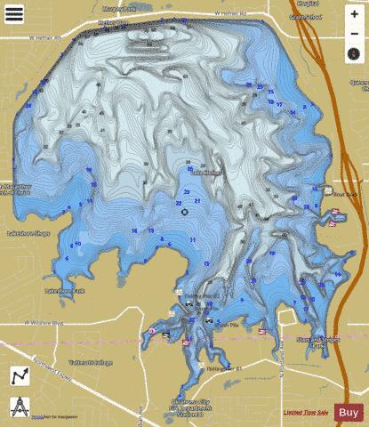
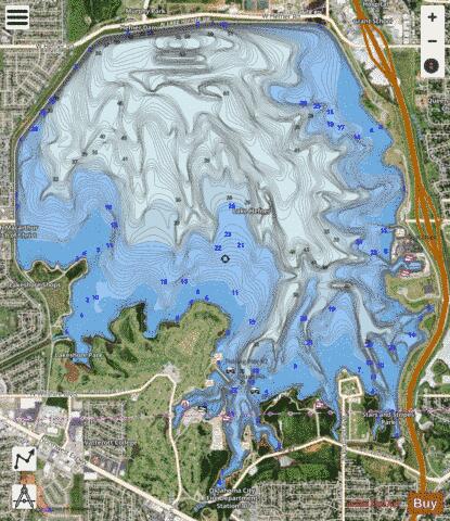
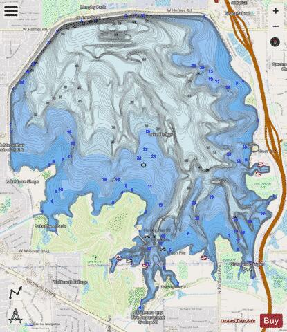
Lake Hefner Fishing Map Stats | |
| Title | Lake Hefner |
| Sailing Clubs in this Chart region | |
| Oklahoma City Boat Club | |
| Scale | 1:24000 |
| Counties | Oklahoma |
| Nearby Cities | The Village, Nichols Hills, Warr Acres, Bethany, Woodlawn Park, Oklahoma City, Lake Aluma, Edmond, Forest Park, Smith Village |
| Area * | 2499.97 acres |
| Shoreline * | 16.41 miles |
| Min Longitude | -97.62 |
| Min Latitude | 35.54 |
| Max Longitude | -97.57 |
| Max Latitude | 35.58 |
| Edition Label 1 | |
| Edition Label 2 | |
| Edition Label 3 | |
| Id | US_OK_hefner |
| Country | US |
| Projection | Mercator |
| * some Stats may include nearby/connecting waterbodies | |
|