Stump Lake fishing map is available as part of iBoating : USA Marine & Fishing App(now supported on multiple platforms including Android, iPhone/iPad, MacBook, and Windows(tablet and phone)/PC based chartplotter.).
With our Lake Maps App, you get all the great marine chart app features like fishing spots, along with Stump Lake depth map. The fishing maps app include HD lake depth contours, along with advanced features found in Fish Finder / Gps Chart Plotter systems, turning your device into a Depth Finder. The Stump Lake Navigation App provides advanced features of a Marine Chartplotter including adjusting water level offset and custom depth shading. Fishing spots and depth contours layers are available in most Lake maps. Lake navigation features include advanced instrumentation to gather wind speed direction, water temperature, water depth, and accurate GPS with AIS receivers(using NMEA over TCP/UDP). Autopilot support can be enabled during ‘Goto WayPoint’ and ‘Route Assistance’.
Now i-Boating supports Fishing Points in Stump Lake.
Have more questions about the Nautical Chart App? Ask us.
Fishing Info for Stump Lake
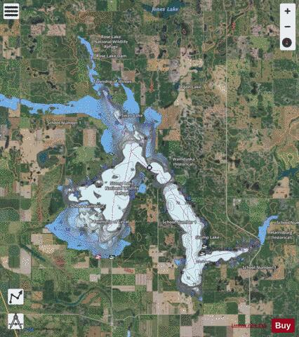
Stump Lake is a naturally formed lake located in Nelson County, North Dakota. It covers 15,742.4 acres, has 72.5 miles of shoreline, and has an average depth of 29.7 feet with a maximum depth of 73.3 feet. It is stocked by the North Dakota Department of Natural Resources with Walleye, Yellow Perch, and Northern Pike. Stump Lake's waters have risen 45 feet in the last few years, and are now at the levels of neighboring Devils Lake. Devil's Lake will overflow into Stump Lake if the surface level reaches 1,447 feet (441 m). Stump Lake, like Devil's Lake, is an endorheic (closed) lake, and has no input or output of rivers or streams, and is only fed by rain or human sources. If water levels exceed 1,458 feet (444 m) the combined lake would flow into the Sheyenne River. This has not occurred since lake levels in this area have been recorded. Stump Lake Park is found around the lake and is solely dedicated to it. Local Native Americans have referred to the lake as "Chicot" which translates as "a place of stumps". The Stump Lake Park is the location of the Old Settler's Pavilion, listed on the U.S. National Register of Historic Places, which has been threatened by the rising water level.
More on Wikipedia...Popular fish species in this lake include Walleye.
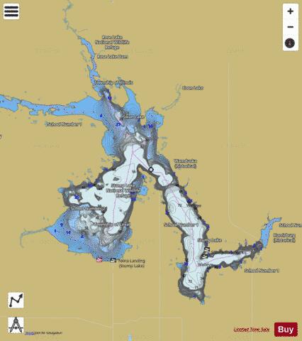
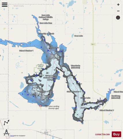
Stump Lake Fishing Map Stats | |
| Title | Stump Lake |
| Scale | 1:24000 |
| Counties | Nelson |
| Nearby Cities | Tolna, Pekin, Lakota, Crary, McVille, Southam, Michigan, Warwick, Brocket, Binford |
| Area * | 17680.68 acres |
| Shoreline * | 91.40 miles |
| Min Longitude | -98.53 |
| Min Latitude | 47.84 |
| Max Longitude | -98.28 |
| Max Latitude | 48.01 |
| Edition Label 1 | |
| Edition Label 2 | |
| Edition Label 3 | |
| Id | US_ND_516 |
| Country | US |
| Projection | Mercator |
| * some Stats may include nearby/connecting waterbodies | |
|