Andrew fishing map is available as part of iBoating : USA Marine & Fishing App(now supported on multiple platforms including Android, iPhone/iPad, MacBook, and Windows(tablet and phone)/PC based chartplotter.).
With our Lake Maps App, you get all the great marine chart app features like fishing spots, along with Andrew lake depth map. The fishing maps app include HD lake depth contours, along with advanced features found in Fish Finder / Gps Chart Plotter systems, turning your device into a Depth Finder. The Andrew Navigation App provides advanced features of a Marine Chartplotter including adjusting water level offset and custom depth shading. Fishing spots and depth contours layers are available in most Lake maps. Lake navigation features include advanced instrumentation to gather wind speed direction, water temperature, water depth, and accurate GPS with AIS receivers(using NMEA over TCP/UDP). Autopilot support can be enabled during ‘Goto WayPoint’ and ‘Route Assistance’.
Now i-Boating supports Fishing Points in Andrew.
Have more questions about the Nautical Chart App? Ask us.
Fishing Info for Andrew
Lake Andrew (also called Lake Andrews) is a lake in Douglas County, in the U.S. state of Minnesota. Lake Andrew is a quiet, spring-fed lake located just south of Alexandria. With a size of 918 acres (3.72 km2), it is popular for recreational activities and a good lake for anglers. The most recent Lake Survey reports mean and maximum depths are 29.0 feet (8.8 m) and 83.0 feet (25.3 m), respectively. Water clarity is considered good. According to Warren Upham, Lake Andrews was probably named for a physician in Alexandria. Alternatively, according to Eugene Roth Family records, Lake Andrew was named for Andrew (Andreas) Roth, a prominent citizen and successful farmer of Douglas County.
More on Wikipedia...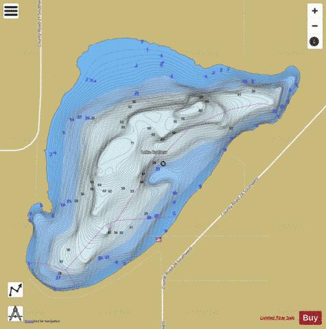
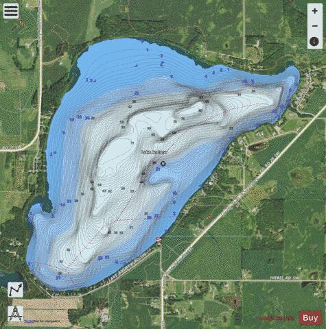
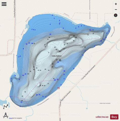
Andrew Fishing Map Stats | |
| Title | Andrew |
| Scale | 1:6000 |
| Counties | Douglas |
| Nearby Cities | Forada, Alexandria, Holmes City, Garfield, Lowry, Nelson, Long Beach, Glenwood, Villard, Carlos |
| Area * | 918.30 acres |
| Shoreline * | 5.60 miles |
| Min Longitude | -95.44 |
| Min Latitude | 45.81 |
| Max Longitude | -95.40 |
| Max Latitude | 45.83 |
| Edition Label 1 | |
| Edition Label 2 | |
| Edition Label 3 | |
| Id | US_MN_21008500 |
| Country | US |
| Projection | Mercator |
| * some Stats may include nearby/connecting waterbodies | |
|