Little Cormorant fishing map is available as part of iBoating : USA Marine & Fishing App(now supported on multiple platforms including Android, iPhone/iPad, MacBook, and Windows(tablet and phone)/PC based chartplotter.).
With our Lake Maps App, you get all the great marine chart app features like fishing spots, along with Little Cormorant lake depth map. The fishing maps app include HD lake depth contours, along with advanced features found in Fish Finder / Gps Chart Plotter systems, turning your device into a Depth Finder. The Little Cormorant Navigation App provides advanced features of a Marine Chartplotter including adjusting water level offset and custom depth shading. Fishing spots and depth contours layers are available in most Lake maps. Lake navigation features include advanced instrumentation to gather wind speed direction, water temperature, water depth, and accurate GPS with AIS receivers(using NMEA over TCP/UDP). Autopilot support can be enabled during ‘Goto WayPoint’ and ‘Route Assistance’.
Now i-Boating supports Fishing Points in Little Cormorant.
Have more questions about the Nautical Chart App? Ask us.
Fishing Info for Little Cormorant
Little Cormorant Lake is a ground water-seepage freshwater lake with no inflow or outflow that is located south of the Audubon Township in Becker County. The lake has a surface area of 924 to 1,067 acres (374 to 432 ha) with a maximum depth of about 34 to 35 ft (10 to 11 m) and an average depth of about 17 ft (5.2 m) and has many bays and small islands. The lake contains many fish species including Walleye, Yellow Bullhead, Largemouth Bass, Northern Pike, Rock Bass, Yellow Perch, Black Bullhead, Bluegill and Brown Bullhead. Little Cormorant Lake is part of the Cormorant Lakes group.
More on Wikipedia...Popular fish species in this lake include Walleye.
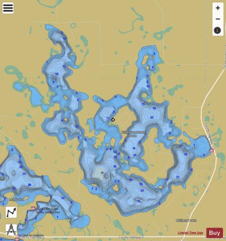
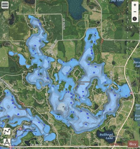
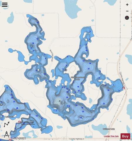
Little Cormorant Fishing Map Stats | |
| Title | Little Cormorant |
| Scale | 1:6000 |
| Counties | Becker |
| Nearby Cities | Audubon, Cormorant, Lake Park, Detroit Lakes, Callaway, Pelican Rapids, Vergas, Richwood, Hitterdal, Hawley |
| Area * | 1066.71 acres |
| Shoreline * | 23.64 miles |
| Min Longitude | -96.04 |
| Min Latitude | 46.79 |
| Max Longitude | -95.99 |
| Max Latitude | 46.83 |
| Edition Label 1 | |
| Edition Label 2 | |
| Edition Label 3 | |
| Id | US_MN_03050600 |
| Country | US |
| Projection | Mercator |
| * some Stats may include nearby/connecting waterbodies | |
|