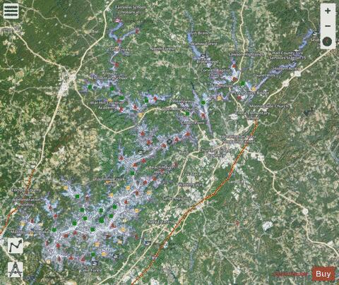
Lake Sidney Lanier fishing map is available as part of iBoating : USA Marine & Fishing App(now supported on multiple platforms including Android, iPhone/iPad, MacBook, and Windows(tablet and phone)/PC based chartplotter.).
With our Lake Maps App, you get all the great marine chart app features like fishing spots, along with Lake Sidney Lanier depth map. The fishing maps app include HD lake depth contours, along with advanced features found in Fish Finder / Gps Chart Plotter systems, turning your device into a Depth Finder. The Lake Sidney Lanier Navigation App provides advanced features of a Marine Chartplotter including adjusting water level offset and custom depth shading. Fishing spots and depth contours layers are available in most Lake maps. Lake navigation features include advanced instrumentation to gather wind speed direction, water temperature, water depth, and accurate GPS with AIS receivers(using NMEA over TCP/UDP). Autopilot support can be enabled during ‘Goto WayPoint’ and ‘Route Assistance’.
Now i-Boating supports Fishing Points in Lake Sidney Lanier.
Have more questions about the Nautical Chart App? Ask us.
Fishing Info for Lake Sidney Lanier
Lake Lanier (officially Lake Sidney Lanier) is a reservoir in the northern portion of the U.S. state of Georgia. It was created by the completion of Buford Dam on the Chattahoochee River in 1956, and is also fed by the waters of the Chestatee River. The lake encompasses 38,000 acres (150 km2) or 59 sq mi (150 km2) of water, and 692 mi (1,114 km) of shoreline at normal level, a "full pool" of 1,071 ft (326 m) above mean sea level and the exact shoreline varies by resolution according to the coastline paradox. Named for poet Sidney Lanier, it was built and is operated by the U.S. Army Corps of Engineers for flood control and water supplies. Its construction destroyed more than 50,000 acres (20,000 ha) of farmland and displaced more than 250 families, 15 businesses, and relocated 20 cemeteries along with their corpses in the process. It is patrolled by the Georgia Department of Natural Resources (GDNR), as well as local law enforcement. The states of Georgia, Alabama and Florida all have rights to the water of the reservoir, as it feeds rivers going through those areas. The Corps of Engineers has responsibilities to regulate flow for flood control and water use. In addition, it has to ensure that water is available to fulfill such federal mandates as under the Endangered Species Act, to support downstream species. The rapid suburbanization of the Atlanta region, in particular, has greatly increased water consumption by private homeowners for lawns and gardens. During droughts of the 21st century, Lake Lanier reached record lows, and regional actions have been needed to reduce area water usage.
More on Wikipedia...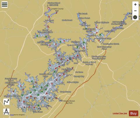
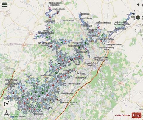
Lake Sidney Lanier Fishing Map Stats | |
| Title | Lake Sidney Lanier |
| Sailing Clubs in this Chart region | |
| Atlanta Inland Sailing Club | |
| Barefoot Sailing Club | |
| Lake Lanier Sailing Club | |
| University Yacht Club | |
| Scale | 1:12000 |
| Counties | Dawson, Forsyth, Gwinnett, Hall, Lumpkin |
| Nearby Cities | Flowery Branch, Gainesville, Rest Haven, Cumming, Oakwood, Buford, Chicopee, Lula, Sugar Hill, Coal Mountain |
| Area * | 38292.71 acres |
| Shoreline * | 704.71 miles |
| Min Longitude | -84.12 |
| Min Latitude | 34.15 |
| Max Longitude | -83.69 |
| Max Latitude | 34.44 |
| Edition Label 1 | |
| Edition Label 2 | |
| Edition Label 3 | |
| Id | US_MM_GA_00322971 |
| Country | US |
| Projection | Mercator |
| * some Stats may include nearby/connecting waterbodies | |
|