Lamberton Lake fishing map is available as part of iBoating : USA Marine & Fishing App(now supported on multiple platforms including Android, iPhone/iPad, MacBook, and Windows(tablet and phone)/PC based chartplotter.).
With our Lake Maps App, you get all the great marine chart app features like fishing spots, along with Lamberton Lake depth map. The fishing maps app include HD lake depth contours, along with advanced features found in Fish Finder / Gps Chart Plotter systems, turning your device into a Depth Finder. The Lamberton Lake Navigation App provides advanced features of a Marine Chartplotter including adjusting water level offset and custom depth shading. Fishing spots and depth contours layers are available in most Lake maps. Lake navigation features include advanced instrumentation to gather wind speed direction, water temperature, water depth, and accurate GPS with AIS receivers(using NMEA over TCP/UDP). Autopilot support can be enabled during ‘Goto WayPoint’ and ‘Route Assistance’.
Now i-Boating supports Fishing Points in Lamberton Lake.
Have more questions about the Nautical Chart App? Ask us.
Fishing Info for Lamberton Lake
Lamberton Lake is a 28.5-acre (115,000 m2) freshwater lake located in Kent County in Western Michigan. The lake is approximately 1,700 feet (520 m) long and 1,040 feet (320 m) wide and is centered at 43°01′N 85°38′W / 43.02°N 85.63°W just within the city limits in northeast Grand Rapids. The surface elevation is 650 feet (200 m), and most of the lake is less than 15 feet (4.6 m) deep. There is one island in the lake, approximately 160 feet (49 m) long and 70 feet (21 m) wide, located in the northwest part of the lake. A low ridge runs along the east side of the lake and overlooks it.
More on Wikipedia...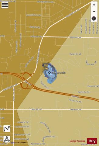
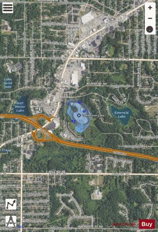
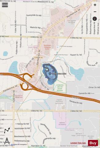
Lamberton Lake Fishing Map Stats | |
| Title | Lamberton Lake |
| Scale | 1:6000 |
| Includes Data from Fish Atlas | Yes |
| Counties | Kent |
| Nearby Cities | Northview, Comstock Park, Grand Rapids, East Grand Rapids, Rockford, Wyoming, Walker, Kentwood, Forest Hills, Sparta |
| Area * | 27.76 acres |
| Shoreline * | 0.99 miles |
| Min Longitude | -85.63 |
| Min Latitude | 43.02 |
| Max Longitude | -85.63 |
| Max Latitude | 43.02 |
| Edition Label 1 | |
| Edition Label 2 | |
| Edition Label 3 | |
| Id | US_MI_41_215 |
| Country | US |
| Projection | Mercator |
| * some Stats may include nearby/connecting waterbodies | |
|