Van Etten Lake fishing map is available as part of iBoating : USA Marine & Fishing App(now supported on multiple platforms including Android, iPhone/iPad, MacBook, and Windows(tablet and phone)/PC based chartplotter.).
With our Lake Maps App, you get all the great marine chart app features like fishing spots, along with Van Etten Lake depth map. The fishing maps app include HD lake depth contours, along with advanced features found in Fish Finder / Gps Chart Plotter systems, turning your device into a Depth Finder. The Van Etten Lake Navigation App provides advanced features of a Marine Chartplotter including adjusting water level offset and custom depth shading. Fishing spots and depth contours layers are available in most Lake maps. Lake navigation features include advanced instrumentation to gather wind speed direction, water temperature, water depth, and accurate GPS with AIS receivers(using NMEA over TCP/UDP). Autopilot support can be enabled during ‘Goto WayPoint’ and ‘Route Assistance’.
Now i-Boating supports Fishing Points in Van Etten Lake.
Have more questions about the Nautical Chart App? Ask us.
Fishing Info for Van Etten Lake
Van Etten Lake is a 1,320-acre (530 ha) lake in Iosco County, Michigan. The lake is largely developed with houses surrounded by dense forest. The bottom is mainly clay and it has a maximum depth of 33 feet (10 m). The lake flows through the Pine River into the Au Sable River and then into Lake Huron. The Van Etten Lake State Forest Campground and Oscoda–Wurtsmith Airport make up large parts of the lakes western shoreline.
More on Wikipedia...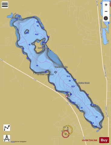
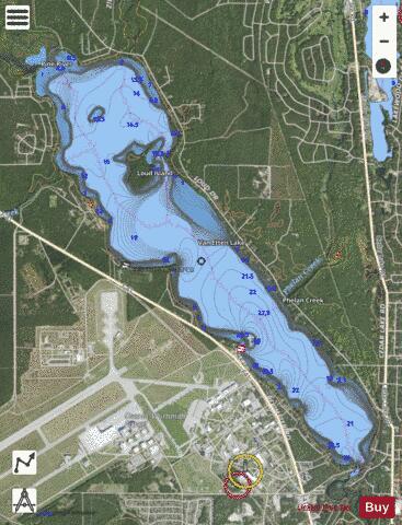
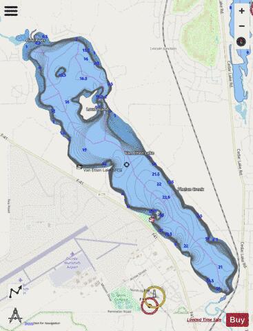
Van Etten Lake Fishing Map Stats | |
| Title | Van Etten Lake |
| Scale | 1:12000 |
| Includes Data from Fish Atlas | Yes |
| Counties | Iosco |
| Nearby Cities | Oscoda, Au Sable, Mikado, Harrisville, Lincoln, East Tawas, Tawas City, Lost Lake Woods, Backus Beach, Black River |
| Area * | 1409.36 acres |
| Shoreline * | 11.79 miles |
| Min Longitude | -83.39 |
| Min Latitude | 44.45 |
| Max Longitude | -83.34 |
| Max Latitude | 44.50 |
| Edition Label 1 | |
| Edition Label 2 | |
| Edition Label 3 | |
| Id | US_MI_35_219 |
| Country | US |
| Projection | Mercator |
| * some Stats may include nearby/connecting waterbodies | |
|