Enchanted Pond fishing map is available as part of iBoating : USA Marine & Fishing App(now supported on multiple platforms including Android, iPhone/iPad, MacBook, and Windows(tablet and phone)/PC based chartplotter.).
With our Lake Maps App, you get all the great marine chart app features like fishing spots, along with Enchanted Pond depth map. The fishing maps app include HD lake depth contours, along with advanced features found in Fish Finder / Gps Chart Plotter systems, turning your device into a Depth Finder. The Enchanted Pond Navigation App provides advanced features of a Marine Chartplotter including adjusting water level offset and custom depth shading. Fishing spots and depth contours layers are available in most Lake maps. Lake navigation features include advanced instrumentation to gather wind speed direction, water temperature, water depth, and accurate GPS with AIS receivers(using NMEA over TCP/UDP). Autopilot support can be enabled during ‘Goto WayPoint’ and ‘Route Assistance’.
Now i-Boating supports Fishing Points in Enchanted Pond.
Have more questions about the Nautical Chart App? Ask us.
Fishing Info for Enchanted Pond
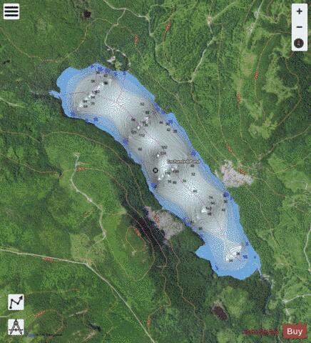
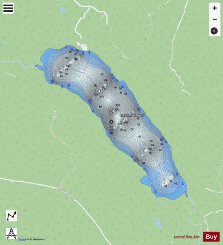
Enchanted Pond is a mountain pond in the U.S. state of Maine. Situated in the Western Maine Mountains in the Northwest Somerset Region, the pond is located in a deep mountain valley between Coburn Mountain (to the east) and Shutdown Mountain (to the west). Near its southern end, the pond is distinguished by two rockslides from the exposed cliffs of these mountains that extend down into the water along both shores. Enchanted Pond is fed by mountain springs and Little Enchanted Pond, and is the primary source of Enchanted Stream which flows into the Dead River, a tributary of the Kennebec River. Development on the pond is limited to a small set of sporting camps at the northern end of the pond and one remote camp on the southwest shore, both a part of Bulldog Camps. There are no islands in the pond. Enchanted Pond is exceptionally deep, and has only a very narrow area of shallow water along its shoreline. Rock and gravel make up the majority of its shores with many large boulders in the rockslide areas and a few sandy beaches, one on the east side directly across from another on the west side, and one on the south shore near the outlet. There is very little aquatic vegetation, resulting in excellent water clarity and oligotrophic conditions.The pond was last surveyed by the State of Maine Inland Fisheries and Wildlife in August, 1979 when the water temperature was determined to be 66 °F at the surface and 41 °F at a depth of 100 feet.
More on Wikipedia...Popular fish species in this lake include Brook trout.
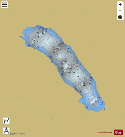
Enchanted Pond Fishing Map Stats | |
| Title | Enchanted Pond |
| Scale | 1:6000 |
| Counties | Somerset |
| Nearby Cities | Lake Parlin, West Forks, Jackman, Long Pond, Moose River, Caratunk, Carrabassett, Eustis, Stratton, Moscow |
| Area * | 333.80 acres |
| Shoreline * | 4.25 miles |
| Min Longitude | -70.20 |
| Min Latitude | 45.42 |
| Max Longitude | -70.17 |
| Max Latitude | 45.44 |
| Edition Label 1 | |
| Edition Label 2 | |
| Edition Label 3 | |
| Id | US_ME_00565915 |
| Country | US |
| Projection | Mercator |
| * some Stats may include nearby/connecting waterbodies | |
|