West Loon Lake fishing map is available as part of iBoating : USA Marine & Fishing App(now supported on multiple platforms including Android, iPhone/iPad, MacBook, and Windows(tablet and phone)/PC based chartplotter.).
With our Lake Maps App, you get all the great marine chart app features like fishing spots, along with West Loon Lake depth map. The fishing maps app include HD lake depth contours, along with advanced features found in Fish Finder / Gps Chart Plotter systems, turning your device into a Depth Finder. The West Loon Lake Navigation App provides advanced features of a Marine Chartplotter including adjusting water level offset and custom depth shading. Fishing spots and depth contours layers are available in most Lake maps. Lake navigation features include advanced instrumentation to gather wind speed direction, water temperature, water depth, and accurate GPS with AIS receivers(using NMEA over TCP/UDP). Autopilot support can be enabled during ‘Goto WayPoint’ and ‘Route Assistance’.
Now i-Boating supports Fishing Points in West Loon Lake.
Have more questions about the Nautical Chart App? Ask us.
Fishing Info for West Loon Lake
Loon Lake is a glacial lake in northern Lake County, Illinois, United States. It comprises three lakes; East Loon, West Loon, and North Loon. (North Loon is not connected). It is located near the town of Antioch, Illinois, near the intersection of Route 83 and Grass Lake Rd. It is home to many different species of fish, birds, reptiles, and amphibians. Some of which are endangered species, including the blacknose shiner.
More on Wikipedia...Popular fish species in this lake include Bowfin, Crappie, Largemouth bass, Northern pike, Pumpkinseed, Rock bass, Walleye, Yellow bullhead and Yellow perch.
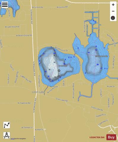
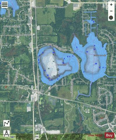
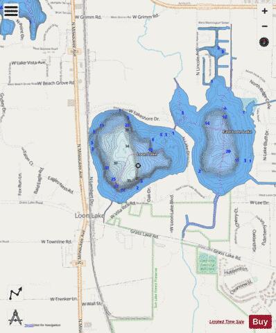
West Loon Lake Fishing Map Stats | |
| Title | West Loon Lake |
| Scale | 1:6000 |
| Counties | Lake |
| Nearby Cities | Antioch, Lake Villa, Lake Shangrila, Fox Lake Hills, Venetian Village, Klondike, Lindenhurst, Round Lake Heights, Round Lake Beach, Millburn |
| Area * | 166.16 acres |
| Shoreline * | 2.40 miles |
| Min Longitude | -88.09 |
| Min Latitude | 42.45 |
| Max Longitude | -88.08 |
| Max Latitude | 42.46 |
| Edition Label 1 | |
| Edition Label 2 | |
| Edition Label 3 | |
| Id | US_IL_lcil_west_loon_lake_il |
| Country | US |
| Projection | Mercator |
| * some Stats may include nearby/connecting waterbodies | |
|