LITTLE LAKE HAMILTON fishing map is available as part of iBoating : USA Marine & Fishing App(now supported on multiple platforms including Android, iPhone/iPad, MacBook, and Windows(tablet and phone)/PC based chartplotter.).
With our Lake Maps App, you get all the great marine chart app features like fishing spots, along with LITTLE LAKE HAMILTON depth map. The fishing maps app include HD lake depth contours, along with advanced features found in Fish Finder / Gps Chart Plotter systems, turning your device into a Depth Finder. The LITTLE LAKE HAMILTON Navigation App provides advanced features of a Marine Chartplotter including adjusting water level offset and custom depth shading. Fishing spots and depth contours layers are available in most Lake maps. Lake navigation features include advanced instrumentation to gather wind speed direction, water temperature, water depth, and accurate GPS with AIS receivers(using NMEA over TCP/UDP). Autopilot support can be enabled during ‘Goto WayPoint’ and ‘Route Assistance’.
Now i-Boating supports Fishing Points in LITTLE LAKE HAMILTON.
Have more questions about the Nautical Chart App? Ask us.
Fishing Info for LITTLE LAKE HAMILTON
Little Lake Hamilton has a surface area of 367-acre (1,490,000 m2). Little Lake Hamilton is bordered by Haines City, Florida, on its north side and is almost bordered by the town of Lake Hamilton, Florida, on its south side. This lake is in places bordered by residences and in other places is bordered by woods and pastureland. It is east of Middle Lake Hamilton and is ironically much larger than that lake. Little Lake Hamilton has no public access along its shores. However, it is part of the north system of the Winter Haven Chain of Lakes. It can be reached by canal from Middle Lake Hamilton, but only tiny boats can navigate this canal. The Take Me Fishing website says this lake contains largemouth bass and bluegill.
More on Wikipedia...Popular fish species in this lake include Largemouth bass.
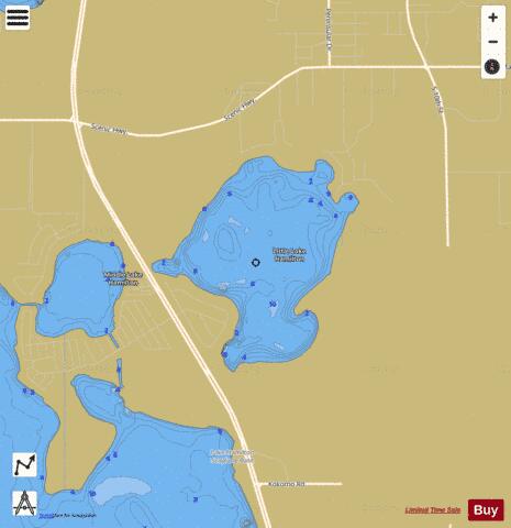
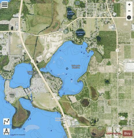
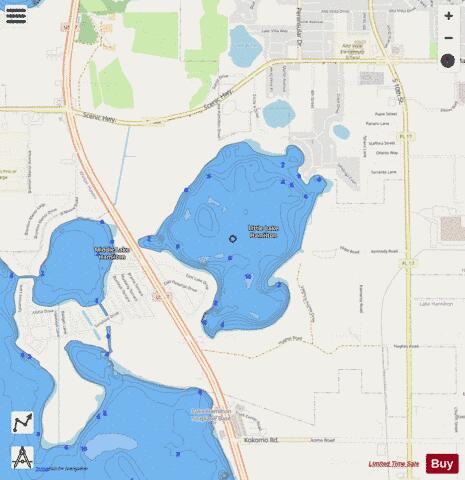
LITTLE LAKE HAMILTON Fishing Map Stats | |
| Title | LITTLE LAKE HAMILTON |
| Scale | 1:6000 |
| 1 ft Depth Contours for Anglers | Yes |
| Counties | Polk |
| Nearby Cities | Lake Hamilton, Haines City, Dundee, Lake Alfred, Waverly, Davenport, Winter Haven, Inwood, Wahneta, Auburndale |
| Area * | 345.46 acres |
| Shoreline * | 3.81 miles |
| Min Longitude | -81.64 |
| Min Latitude | 28.06 |
| Max Longitude | -81.63 |
| Max Latitude | 28.08 |
| Edition Label 1 | |
| Edition Label 2 | |
| Edition Label 3 | |
| Id | US_FL_00285728 |
| Country | US |
| Projection | Mercator |
| * some Stats may include nearby/connecting waterbodies | |
|