LAKE HUNTER fishing map is available as part of iBoating : USA Marine & Fishing App(now supported on multiple platforms including Android, iPhone/iPad, MacBook, and Windows(tablet and phone)/PC based chartplotter.).
With our Lake Maps App, you get all the great marine chart app features like fishing spots, along with LAKE HUNTER depth map. The fishing maps app include HD lake depth contours, along with advanced features found in Fish Finder / Gps Chart Plotter systems, turning your device into a Depth Finder. The LAKE HUNTER Navigation App provides advanced features of a Marine Chartplotter including adjusting water level offset and custom depth shading. Fishing spots and depth contours layers are available in most Lake maps. Lake navigation features include advanced instrumentation to gather wind speed direction, water temperature, water depth, and accurate GPS with AIS receivers(using NMEA over TCP/UDP). Autopilot support can be enabled during ‘Goto WayPoint’ and ‘Route Assistance’.
Now i-Boating supports Fishing Points in LAKE HUNTER.
Have more questions about the Nautical Chart App? Ask us.
Fishing Info for LAKE HUNTER
Lake Hunter, a pear-shaped lake, has a surface area of 93 acres (380,000 m2). This lake is inside Lakeland, Florida, and the area surrounding it is completely urbanized. It is bordered on the northeast by residences and the Lake Hunter Boat Ramp. On the lakes's north and west it is bordered by Sikes Boulevard and on the south and southeast by Lake Hunter Drive. The Lake Hunter Terrace Historic District borders the lake along Sikes Boulevard. Lake Hunter provides public access along most of its , since a public sidewalk travels three-fourths of the way around it. Also, the Lake Hunter Boat Ramp is a public boat ramp. There are no swimming beaches along the lake's shore. This lake contains largemouth bass and bluegill. On June 7, 2016 the body of a dead man was found in the mouth of an alligator on the shore of Lake Hunter. When officials arrived at the scene, the alligator let go of the body and swam away, police said. At the time it wasn't known if the alligator killed the person or simply found the dead body. Lake Hunter bears the name of one Mr. Hunter, who often visited the lake in earlier days.
More on Wikipedia...Popular fish species in this lake include Largemouth bass.
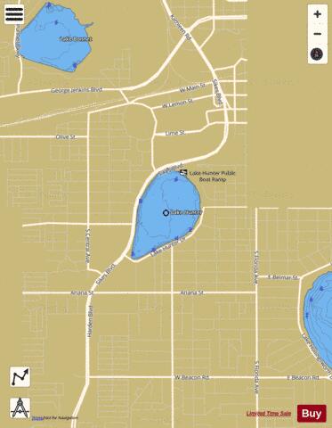

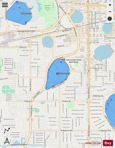
LAKE HUNTER Fishing Map Stats | |
| Title | LAKE HUNTER |
| Scale | 1:3000 |
| 1 ft Depth Contours for Anglers | Yes |
| Counties | Polk |
| Nearby Cities | Lakeland, Winston, Eaton Park, Medulla, Gibsonia, Kathleen, Highland City, Providence, Fuller Heights, Mulberry |
| Area * | 91.35 acres |
| Shoreline * | 1.51 miles |
| Min Longitude | -81.97 |
| Min Latitude | 28.03 |
| Max Longitude | -81.96 |
| Max Latitude | 28.04 |
| Edition Label 1 | |
| Edition Label 2 | |
| Edition Label 3 | |
| Id | US_FL_00284407 |
| Country | US |
| Projection | Mercator |
| * some Stats may include nearby/connecting waterbodies | |
|