LAKE ECHO fishing map is available as part of iBoating : USA Marine & Fishing App(now supported on multiple platforms including Android, iPhone/iPad, MacBook, and Windows(tablet and phone)/PC based chartplotter.).
With our Lake Maps App, you get all the great marine chart app features like fishing spots, along with LAKE ECHO depth map. The fishing maps app include HD lake depth contours, along with advanced features found in Fish Finder / Gps Chart Plotter systems, turning your device into a Depth Finder. The LAKE ECHO Navigation App provides advanced features of a Marine Chartplotter including adjusting water level offset and custom depth shading. Fishing spots and depth contours layers are available in most Lake maps. Lake navigation features include advanced instrumentation to gather wind speed direction, water temperature, water depth, and accurate GPS with AIS receivers(using NMEA over TCP/UDP). Autopilot support can be enabled during ‘Goto WayPoint’ and ‘Route Assistance’.
Now i-Boating supports Fishing Points in LAKE ECHO.
Have more questions about the Nautical Chart App? Ask us.
Fishing Info for LAKE ECHO
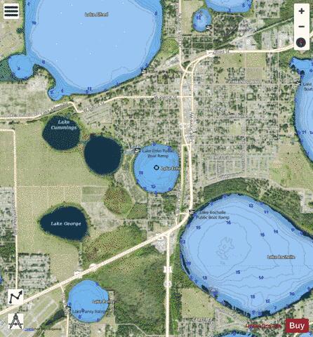
Lake Echo, which is almost round, has a surface area of 68.92-acre (278,900 m2). Lake Echo is inside the city of Lake Alfred, Florida. The north and east shores and part of the south shore are bordered by residences. The west and southwest shores are bordered by citrus groves. The southeast shore is bordered by a wooded area. is 360 feet (110 m) west of Lake Echo. Lake Echo has public access at two places. One is on the northwest side of the lake, at the end of South Winona Avenue. Here is the Lake Echo Boat Ramp, which consists of a public boat ramp and public fishing dock/boat dock. On the south side of the lake, at the end of South Nekoma Avenue, is the Echo Terrace Dock. This consists of a public fishing dock and picnic table. The lake has no public swimming beach. Also, a canal on the southeast shore goes to nearby Lake Rochelle. This canal, however, is not always full of water and cannot be navigated by any boats. Technically, since Lake Echo is connected by a canal to Lake Rochelle, it is part of the northern system of the Winter Haven Chain of Lakes. There is no information on Lake Echo about the types of fish in the lake.
More on Wikipedia...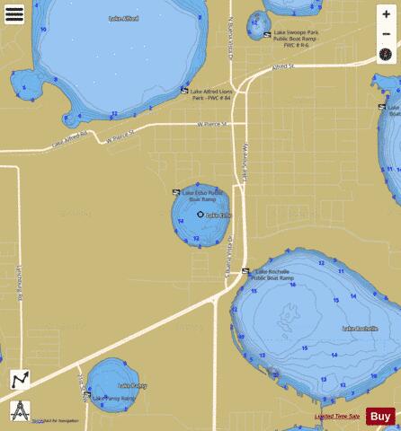
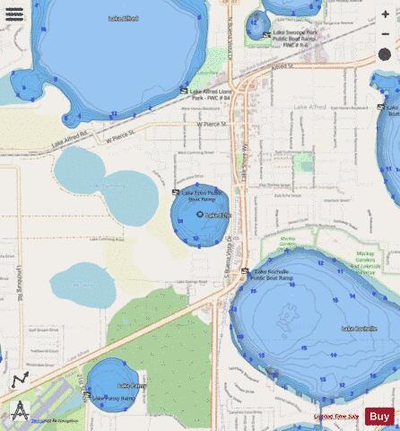
LAKE ECHO Fishing Map Stats | |
| Title | LAKE ECHO |
| Scale | 1:3000 |
| 1 ft Depth Contours for Anglers | Yes |
| Counties | Polk |
| Nearby Cities | Lake Alfred, Inwood, Auburndale, Winter Haven, Eagle Lake, Lake Hamilton, Haines City, Dundee, Wahneta, Polk City |
| Area * | 67.13 acres |
| Shoreline * | 1.17 miles |
| Min Longitude | -81.74 |
| Min Latitude | 28.08 |
| Max Longitude | -81.73 |
| Max Latitude | 28.09 |
| Edition Label 1 | |
| Edition Label 2 | |
| Edition Label 3 | |
| Id | US_FL_00282073 |
| Country | US |
| Projection | Mercator |
| * some Stats may include nearby/connecting waterbodies | |
|