BANANA LAKE fishing map is available as part of iBoating : USA Marine & Fishing App(now supported on multiple platforms including Android, iPhone/iPad, MacBook, and Windows(tablet and phone)/PC based chartplotter.).
With our Lake Maps App, you get all the great marine chart app features like fishing spots, along with BANANA LAKE depth map. The fishing maps app include HD lake depth contours, along with advanced features found in Fish Finder / Gps Chart Plotter systems, turning your device into a Depth Finder. The BANANA LAKE Navigation App provides advanced features of a Marine Chartplotter including adjusting water level offset and custom depth shading. Fishing spots and depth contours layers are available in most Lake maps. Lake navigation features include advanced instrumentation to gather wind speed direction, water temperature, water depth, and accurate GPS with AIS receivers(using NMEA over TCP/UDP). Autopilot support can be enabled during ‘Goto WayPoint’ and ‘Route Assistance’.
Now i-Boating supports Fishing Points in BANANA LAKE.
Have more questions about the Nautical Chart App? Ask us.
Fishing Info for BANANA LAKE
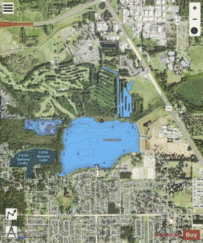
Banana Lake or is a 268-acre (1,080,000 m2) natural freshwater lake in southeast Lakeland, Florida. Before 1860 this lake was called Mud Lake. A family homesteaded at the lake and planted bananas, amongst other types of fruit. By 1890 the lake was known by its current name. Banana Lake is in a suburban area. Residential areas and agricultural areas surround it. To the southwest 200 feet (61 m) is . is 400 feet (120 m) to the northwest. Just to the north of Lake Stahl is the Sanlan Golf Course, which also borders Banana Lake. On the south shore of the lake is Banana Lake Park, which has an address of 5002 Tillery Road. This park contains picnic shelters and tables, a paved walking trail, restrooms, a playground, a boat ramp and a fishing pier. A parking lot is at the west side of the park. Boats can reach Lake Stahl via a canal that connects the two lakes.
More on Wikipedia...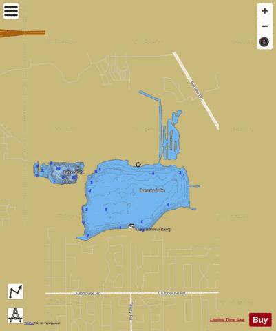
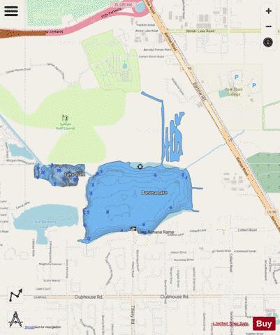
BANANA LAKE Fishing Map Stats | |
| Title | BANANA LAKE |
| Scale | 1:6000 |
| 1 ft Depth Contours for Anglers | Yes |
| Counties | Polk |
| Nearby Cities | Eaton Park, Highland City, Medulla, Lakeland, Bartow, Mulberry, Fuller Heights, Winston, Auburndale, Eagle Lake |
| Area * | 259.97 acres |
| Shoreline * | 6.54 miles |
| Min Longitude | -81.91 |
| Min Latitude | 27.97 |
| Max Longitude | -81.89 |
| Max Latitude | 27.99 |
| Edition Label 1 | |
| Edition Label 2 | |
| Edition Label 3 | |
| Id | US_FL_00278076 |
| Country | US |
| Projection | Mercator |
| * some Stats may include nearby/connecting waterbodies | |
|