Aurora Reservoir fishing map is available as part of iBoating : USA Marine & Fishing App(now supported on multiple platforms including Android, iPhone/iPad, MacBook, and Windows(tablet and phone)/PC based chartplotter.).
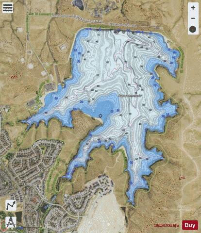
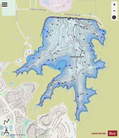
With our Lake Maps App, you get all the great marine chart app features like fishing spots, along with Aurora Reservoir depth map. The fishing maps app include HD lake depth contours, along with advanced features found in Fish Finder / Gps Chart Plotter systems, turning your device into a Depth Finder. The Aurora Reservoir Navigation App provides advanced features of a Marine Chartplotter including adjusting water level offset and custom depth shading. Fishing spots and depth contours layers are available in most Lake maps. Lake navigation features include advanced instrumentation to gather wind speed direction, water temperature, water depth, and accurate GPS with AIS receivers(using NMEA over TCP/UDP). Autopilot support can be enabled during ‘Goto WayPoint’ and ‘Route Assistance’.
Now i-Boating supports Fishing Points in Aurora Reservoir.
Have more questions about the Nautical Chart App? Ask us.
Fishing Info for Aurora Reservoir
Aurora Reservoir is a 31,650 acre-foot (39,040,000 m3) reservoir located in the far southeastern reach of Aurora, Colorado. Senac Creek and other minor streams flow into the reservoir's three coves, Senac, Marina and Lone Tree, each pointing to the south. The reservoir provides drinking water to the City of Aurora, and is also a recreation area.
More on Wikipedia...Popular fish species in this lake include Walleye.
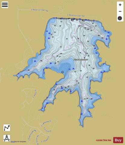
Aurora Reservoir Fishing Map Stats | |
| Title | Aurora Reservoir |
| Scale | 1:6000 |
| Counties | Arapahoe |
| Nearby Cities | Foxfield, Parker, Watkins, Aurora, Lone Tree, Centennial, Franktown, Elizabeth, Castle Pines, Bennett |
| Area * | 735.45 acres |
| Shoreline * | 9.46 miles |
| Min Longitude | -104.68 |
| Min Latitude | 39.60 |
| Max Longitude | -104.65 |
| Max Latitude | 39.62 |
| Edition Label 1 | |
| Edition Label 2 | |
| Edition Label 3 | |
| Id | US_DL_CO_01947706 |
| Country | US |
| Projection | Mercator |
| * some Stats may include nearby/connecting waterbodies | |
|