Morrow Point Reservoir fishing map is available as part of iBoating : USA Marine & Fishing App(now supported on multiple platforms including Android, iPhone/iPad, MacBook, and Windows(tablet and phone)/PC based chartplotter.).
With our Lake Maps App, you get all the great marine chart app features like fishing spots, along with Morrow Point Reservoir depth map. The fishing maps app include HD lake depth contours, along with advanced features found in Fish Finder / Gps Chart Plotter systems, turning your device into a Depth Finder. The Morrow Point Reservoir Navigation App provides advanced features of a Marine Chartplotter including adjusting water level offset and custom depth shading. Fishing spots and depth contours layers are available in most Lake maps. Lake navigation features include advanced instrumentation to gather wind speed direction, water temperature, water depth, and accurate GPS with AIS receivers(using NMEA over TCP/UDP). Autopilot support can be enabled during ‘Goto WayPoint’ and ‘Route Assistance’.
Now i-Boating supports Fishing Points in Morrow Point Reservoir.
Have more questions about the Nautical Chart App? Ask us.
Fishing Info for Morrow Point Reservoir
Morrow Point Reservoir is an 817-acre artificial reservoir on the Gunnison River in western Colorado. Located in the upper Black Canyon of the Gunnison, the lake was created in 1968 by the U.S. Bureau of Reclamation as part of a larger plan to impound the upper section of the Gunnison and create opportunities for hydroelectric power generation, water conservation, and recreation. Morrow Point Reservoir is managed by the National Park Service as a unit within the Curecanti National Recreation Area, and is the location of the Curecanti Needle, a striking 700 ft. granite spire on the reservoir's southern bank whose unique shape was for decades a recognized symbol of the Denver and Rio Grande Western Railroad.
More on Wikipedia...
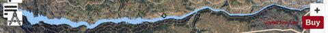
Morrow Point Reservoir Fishing Map Stats | |
| Title | Morrow Point Reservoir |
| Scale | 1:6000 |
| Counties | Gunnison, Montrose |
| Nearby Cities | Cimarron, Crawford, Colona, Powderhorn, Montrose, Ridgway, Hotchkiss, Portland, Lazear, Paonia |
| Area * | 774.74 acres |
| Shoreline * | 25.86 miles |
| Min Longitude | -107.54 |
| Min Latitude | 38.44 |
| Max Longitude | -107.33 |
| Max Latitude | 38.45 |
| Edition Label 1 | |
| Edition Label 2 | |
| Edition Label 3 | |
| Id | US_CO_00188199 |
| Country | US |
| Projection | Mercator |
| * some Stats may include nearby/connecting waterbodies | |
|