Caballo Lake fishing map is available as part of iBoating : USA Marine & Fishing App(now supported on multiple platforms including Android, iPhone/iPad, MacBook, and Windows(tablet and phone)/PC based chartplotter.).
With our Lake Maps App, you get all the great marine chart app features like fishing spots, along with Caballo Lake depth map. The fishing maps app include HD lake depth contours, along with advanced features found in Fish Finder / Gps Chart Plotter systems, turning your device into a Depth Finder. The Caballo Lake Navigation App provides advanced features of a Marine Chartplotter including adjusting water level offset and custom depth shading. Fishing spots and depth contours layers are available in most Lake maps. Lake navigation features include advanced instrumentation to gather wind speed direction, water temperature, water depth, and accurate GPS with AIS receivers(using NMEA over TCP/UDP). Autopilot support can be enabled during ‘Goto WayPoint’ and ‘Route Assistance’.
Now i-Boating supports Fishing Points in Caballo Lake.
Have more questions about the Nautical Chart App? Ask us.
Fishing Info for Caballo Lake
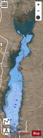
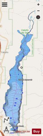
Caballo Lake is a reservoir on the Rio Grande created by the Caballo Dam in southern New Mexico, United States. It is the fourth largest reservoir in New Mexico in terms of surface area and the fifth largest body of water in New Mexico in terms of volume. The lake is in Caballo Lake State Park, which is approximately 16 miles (26 km) south of Truth or Consequences. The lake is used for recreational activities, such as boating, swimming, waterskiing, and fishing. Fish in the lake include walleye, bass, catfish, crappie, and bluegill. Caballo Lake is also a birdwatching site. Many migratory birds use the lake as a rest stop during their travels, and eagles are often seen in the area. Caballo Lake is named for the Caballo Mountains that border the lake to the northeast, east, and southeast, in which wild horses roamed; Caballo means "horse" in Spanish. The upper area of the lake is very shallow and, in times of low water, has been blocked from the lower, deeper end of the lake. The water has a slightly brownish hue from a distance, due to the shallow waters (usually about 75 feet (23 m) at the deepest point). The beaches of Caballo are rocky when compared to Elephant Butte Reservoir, but there are many sandy areas. Beware of the whirlpool at the dam, as it can be a hazard.
More on Wikipedia...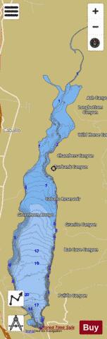
Caballo Lake Fishing Map Stats | |
| Title | Caballo Lake |
| Scale | 1:24000 |
| Counties | Sierra |
| Nearby Cities | Oasis, Caballo, Las Palomas, Arrey, Williamsburg, Truth or Consequences, Garfield, Elephant Butte, Hot Springs Landing, Salem |
| Area * | 3296.89 acres |
| Shoreline * | 24.97 miles |
| Min Longitude | -107.31 |
| Min Latitude | 32.90 |
| Max Longitude | -107.27 |
| Max Latitude | 33.02 |
| Edition Label 1 | |
| Edition Label 2 | |
| Edition Label 3 | |
| Id | US_CC_NM_caballo_lake_nm |
| Country | US |
| Projection | Mercator |
| * some Stats may include nearby/connecting waterbodies | |
|