Lake Saltonstall fishing map is available as part of iBoating : USA Marine & Fishing App(now supported on multiple platforms including Android, iPhone/iPad, MacBook, and Windows(tablet and phone)/PC based chartplotter.).
With our Lake Maps App, you get all the great marine chart app features like fishing spots, along with Lake Saltonstall depth map. The fishing maps app include HD lake depth contours, along with advanced features found in Fish Finder / Gps Chart Plotter systems, turning your device into a Depth Finder. The Lake Saltonstall Navigation App provides advanced features of a Marine Chartplotter including adjusting water level offset and custom depth shading. Fishing spots and depth contours layers are available in most Lake maps. Lake navigation features include advanced instrumentation to gather wind speed direction, water temperature, water depth, and accurate GPS with AIS receivers(using NMEA over TCP/UDP). Autopilot support can be enabled during ‘Goto WayPoint’ and ‘Route Assistance’.
Now i-Boating supports Fishing Points in Lake Saltonstall.
Have more questions about the Nautical Chart App? Ask us.
Fishing Info for Lake Saltonstall
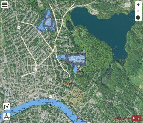
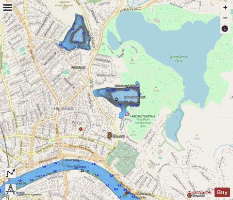
Lake Saltonstall, referred to locally as Plug Pond, is a small lake located in the southwest park of the Winnekenni Park Conservation Area, near Winnekenni Castle, in Haverhill, Massachusetts. Accessible via the main entrance on Sanders Road or through trails leading from Winnikenni Castle, Lake Saltonstall has an area open to the public, and another reserved exclusively for Haverhill residents. During the summer months, it is open to residents for swimming, municipal boating programs, and picnicking with bathroom facilities. Residents and non-residents alike may fish on Lake Saltonstall as it is a state-stocked fishing area.
More on Wikipedia...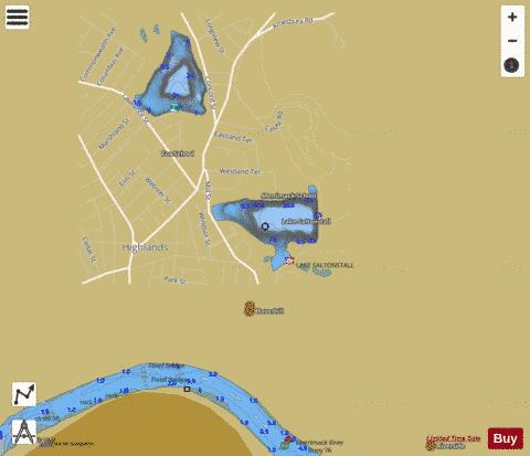
Lake Saltonstall Fishing Map Stats | |
| Title | Lake Saltonstall |
| Scale | 1:3000 |
| Counties | Essex |
| Nearby Cities | Haverhill, Groveland, Plaistow, West Boxford, West Newbury, Merrimac, Newton, Georgetown, Atkinson, North Andover |
| Area * | 44.09 acres |
| Shoreline * | 1.42 miles |
| Min Longitude | -71.07 |
| Min Latitude | 42.78 |
| Max Longitude | -71.06 |
| Max Latitude | 42.79 |
| Edition Label 1 | |
| Edition Label 2 | |
| Edition Label 3 | |
| Id | US_CC_MA_lake_saltonstall_jul21_ma |
| Country | US |
| Projection | Mercator |
| * some Stats may include nearby/connecting waterbodies | |
|