Fielding fishing map is available as part of iBoating : USA Marine & Fishing App(now supported on multiple platforms including Android, iPhone/iPad, MacBook, and Windows(tablet and phone)/PC based chartplotter.).
With our Lake Maps App, you get all the great marine chart app features like fishing spots, along with Fielding lake depth map. The fishing maps app include HD lake depth contours, along with advanced features found in Fish Finder / Gps Chart Plotter systems, turning your device into a Depth Finder. The Fielding Navigation App provides advanced features of a Marine Chartplotter including adjusting water level offset and custom depth shading. Fishing spots and depth contours layers are available in most Lake maps. Lake navigation features include advanced instrumentation to gather wind speed direction, water temperature, water depth, and accurate GPS with AIS receivers(using NMEA over TCP/UDP). Autopilot support can be enabled during ‘Goto WayPoint’ and ‘Route Assistance’.
Now i-Boating supports Fishing Points in Fielding.
Have more questions about the Nautical Chart App? Ask us.
Fishing Info for Fielding
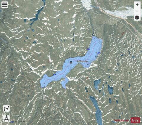
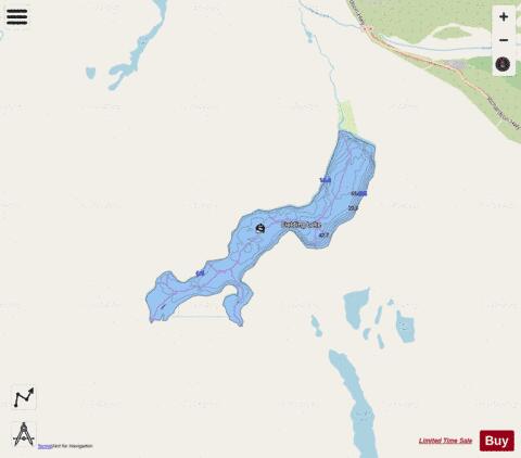
Fielding Lake is an Alaskan lake adjacent to the Richardson Highway, two miles (3.2 km) north of Isabel Pass in the Alaska Range. As an alpine lake, it freezes early in autumn, and ice can remain on portions of the lake as late as July. The lake has good fishing for grayling, burbot and trout, all of which are native populations and not stocked. The lake bottom is mud and gravel, with heavy vegetation in shallow areas. The area around the lake is described as "barren, rolling tundra". The entirety of the lake itself is public, but some areas of the shore are private property.
More on Wikipedia...Popular fish species in this lake include Burbot and Lake trout.
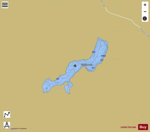
Fielding Fishing Map Stats | |
| Title | Fielding |
| Scale | 1:6000 |
| Counties | Valdez-Cordova |
| Nearby Cities | Paxson, Donnelly, Deltana, Delta Junction, Gulkana, Gakona, Big Delta |
| Area * | 1321.75 acres |
| Shoreline * | 12.07 miles |
| Min Longitude | -145.74 |
| Min Latitude | 63.15 |
| Max Longitude | -145.64 |
| Max Latitude | 63.19 |
| Edition Label 1 | |
| Edition Label 2 | |
| Edition Label 3 | |
| Id | US_AK_ak_reg3_fieldingcontours_meters |
| Country | US |
| Projection | Mercator |
| * some Stats may include nearby/connecting waterbodies | |
|