Alma Lake fishing map is available as part of iBoating : USA Marine & Fishing App(now supported on multiple platforms including Android, iPhone/iPad, MacBook, and Windows(tablet and phone)/PC based chartplotter.).
With our Lake Maps App, you get all the great marine chart app features like fishing spots, along with Alma Lake depth map. The fishing maps app include HD lake depth contours, along with advanced features found in Fish Finder / Gps Chart Plotter systems, turning your device into a Depth Finder. The Alma Lake Navigation App provides advanced features of a Marine Chartplotter including adjusting water level offset and custom depth shading. Fishing spots and depth contours layers are available in most Lake maps. Lake navigation features include advanced instrumentation to gather wind speed direction, water temperature, water depth, and accurate GPS with AIS receivers(using NMEA over TCP/UDP). Autopilot support can be enabled during ‘Goto WayPoint’ and ‘Route Assistance’.
Now i-Boating supports Fishing Points in Alma Lake.
Have more questions about the Nautical Chart App? Ask us.
Fishing Info for Alma Lake
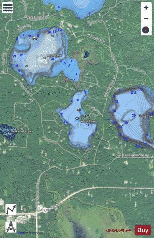
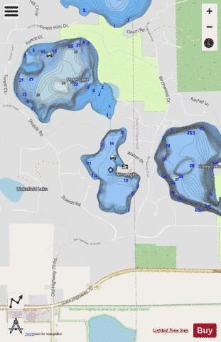
Alma Lake, located in North-Central Wisconsin in Vilas County, near the town of St. Germain, is a small 57.7-acre (233,500 sq. meters) lake with a maximum depth of 5.5 meters (18 feet), and a mean depth of 3.4 meters (11 feet). The lake bottom is composed of 50% sand, 40% gravel, and 10% mulch. Alma Lake has one public boat landing located on Red Oak Road, off Birchwood Drive. The lake always has a slow, no-wake ordinance.
More on Wikipedia...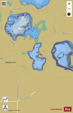
Alma Lake Fishing Map Stats | |
| Title | Alma Lake |
| Scale | 1:3000 |
| Counties | Vilas |
| Nearby Cities | Saint Germain, Sayner, Sugar Camp, Eagle River, Lake Tomahawk, McNaughton, Conover, Newbold, Arbor Vitae, Clearwater Lake |
| Area * | 57.77 acres |
| Shoreline * | 1.65 miles |
| Min Longitude | -89.43 |
| Min Latitude | 45.91 |
| Max Longitude | -89.42 |
| Max Latitude | 45.91 |
| Edition Label 1 | |
| Edition Label 2 | |
| Edition Label 3 | |
| Id | US_AA_WI_alma_lake_wi |
| Country | US |
| Projection | Mercator |
| * some Stats may include nearby/connecting waterbodies | |
|