Lake Waccamaw fishing map is available as part of iBoating : USA Marine & Fishing App(now supported on multiple platforms including Android, iPhone/iPad, MacBook, and Windows(tablet and phone)/PC based chartplotter.).
With our Lake Maps App, you get all the great marine chart app features like fishing spots, along with Lake Waccamaw depth map. The fishing maps app include HD lake depth contours, along with advanced features found in Fish Finder / Gps Chart Plotter systems, turning your device into a Depth Finder. The Lake Waccamaw Navigation App provides advanced features of a Marine Chartplotter including adjusting water level offset and custom depth shading. Fishing spots and depth contours layers are available in most Lake maps. Lake navigation features include advanced instrumentation to gather wind speed direction, water temperature, water depth, and accurate GPS with AIS receivers(using NMEA over TCP/UDP). Autopilot support can be enabled during ‘Goto WayPoint’ and ‘Route Assistance’.
Have more questions about the Nautical Chart App? Ask us.
Fishing Info for Lake Waccamaw
Lake Waccamaw is a fresh water lake located in Columbus County in North Carolina. It is the largest of the natural Carolina Bay lakes. Although bay trees (Magnolia virginiana L., Gordonia lasianthus Ellis, and Persea) are present within many Carolina Bays, the term "bay" does not refer to the trees but comes instead from an early science publication by Glenn (1895), who used the word "bay" (which he described as "lake-like expanses") to refer to these features near the town of Darlington, South Carolina. Lake Waccamaw is fed by four creeks: First, Second, Third, and Big creeks. The outlet forms the Waccamaw River which flows south-southwest to empty into the Atlantic Ocean near Georgetown, South Carolina
More on Wikipedia...Popular fish species in this lake include Ameiurus platycephalus, Enneacanthus gloriosus and Notropis petersoni.
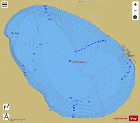
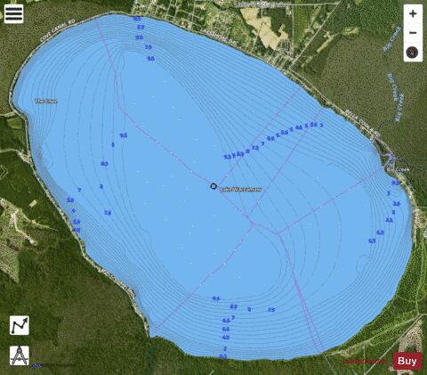
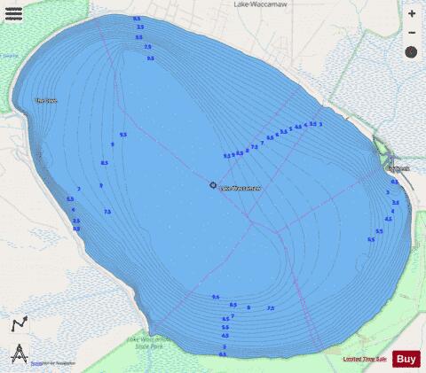
Lake Waccamaw Fishing Map Stats | |
| Title | Lake Waccamaw |
| Scale | 1:12000 |
| Counties | Columbus |
| Nearby Cities | Lake Waccamaw, Hallsboro, Bolton, Brunswick, Freeland, Whiteville, East Arcadia, Sandyfield, Clarkton, Kelly |
| Area * | 8839.87 acres |
| Shoreline * | 17.98 miles |
| Min Longitude | -78.55 |
| Min Latitude | 34.26 |
| Max Longitude | -78.47 |
| Max Latitude | 34.32 |
| Edition Label 1 | |
| Edition Label 2 | |
| Edition Label 3 | |
| Id | US_AA_NC_lake_waccamaw_nc |
| Country | US |
| Projection | Mercator |
| * some Stats may include nearby/connecting waterbodies | |
|