John H. Kerr Reservoir / Buggs Island Lake fishing map is available as part of iBoating : USA Marine & Fishing App(now supported on multiple platforms including Android, iPhone/iPad, MacBook, and Windows(tablet and phone)/PC based chartplotter.).
With our Lake Maps App, you get all the great marine chart app features like fishing spots, along with John H. Kerr Reservoir / Buggs Island Lake depth map. The fishing maps app include HD lake depth contours, along with advanced features found in Fish Finder / Gps Chart Plotter systems, turning your device into a Depth Finder. The John H. Kerr Reservoir / Buggs Island Lake Navigation App provides advanced features of a Marine Chartplotter including adjusting water level offset and custom depth shading. Fishing spots and depth contours layers are available in most Lake maps. Lake navigation features include advanced instrumentation to gather wind speed direction, water temperature, water depth, and accurate GPS with AIS receivers(using NMEA over TCP/UDP). Autopilot support can be enabled during ‘Goto WayPoint’ and ‘Route Assistance’.
Now i-Boating supports Fishing Points in John H. Kerr Reservoir / Buggs Island Lake.
Have more questions about the Nautical Chart App? Ask us.
Fishing Info for John H. Kerr Reservoir / Buggs Island Lake
Kerr Lake /kɑr/ (officially John H. Kerr Reservoir, also known as Bugg's Island Lake) is a reservoir along the border of the U.S. states of North Carolina and Virginia. It is impounded by the John H. Kerr Dam, constructed between 1947 and 1952 to produce hydroelectricity and to provide flood control. Kerr Lake is owned by the US Army Corps of Engineers, and is the largest reservoir in Virginia. It is located in parts of Vance, Granville, and Warren counties in North Carolina, and Mecklenburg, Charlotte, and Halifax counties in Virginia. At its maximum capacity, it is one of the largest reservoirs in the Southeastern United States, covering approximately 50,000 acres (200 km2) and bordered by over 850 miles (1,370 km) of shoreline. The lake is named for Congressman John H. Kerr of North Carolina, who supported the original creation of the lake. The lake is an impoundment of the Roanoke River (also called the Staunton River in Virginia). The Dan River and several smaller creeks also feed the lake. The lake is upstream of Lake Gaston. Just downstream from the John H. Kerr Dam, and visible from the viewing platform below the dam at Tailrace Park, lies Buggs Island, named for Samuel Bugg, an early settler. North Carolinians know this body of water as Kerr Lake, while Virginians know it as Buggs Island Lake or Buggs Island Reservoir. The large lake is widely popular with both North Carolinians and Virginians for fishing and recreational purposes.
More on Wikipedia...Popular fish species in this lake include Crappie and Striped bass.
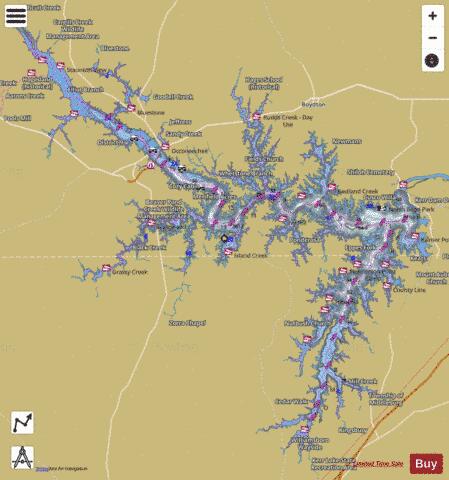
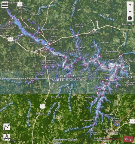
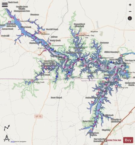
John H. Kerr Reservoir / Buggs Island Lake Fishing Map Stats | |
| Title | John H. Kerr Reservoir / Buggs Island Lake |
| Scale | 1:12000 |
| Counties | Granville, Vance, Warren, Charlotte, Halifax, Mecklenburg |
| Nearby Cities | Clarksville, Boydton, Townsville, Middleburg, Henderson, South Henderson, Stovall, Nelson, Baskerville, Scottsburg |
| Area * | 43005.40 acres |
| Shoreline * | 729.77 miles |
| Min Longitude | -78.80 |
| Min Latitude | 36.36 |
| Max Longitude | -78.26 |
| Max Latitude | 36.74 |
| Edition Label 1 | |
| Edition Label 2 | |
| Edition Label 3 | |
| Id | US_AA_NC_kerr_buggs_island_nc |
| Country | US |
| Projection | Mercator |
| * some Stats may include nearby/connecting waterbodies | |
|