James Lake fishing map is available as part of iBoating : USA Marine & Fishing App(now supported on multiple platforms including Android, iPhone/iPad, MacBook, and Windows(tablet and phone)/PC based chartplotter.).
With our Lake Maps App, you get all the great marine chart app features like fishing spots, along with James Lake depth map. The fishing maps app include HD lake depth contours, along with advanced features found in Fish Finder / Gps Chart Plotter systems, turning your device into a Depth Finder. The James Lake Navigation App provides advanced features of a Marine Chartplotter including adjusting water level offset and custom depth shading. Fishing spots and depth contours layers are available in most Lake maps. Lake navigation features include advanced instrumentation to gather wind speed direction, water temperature, water depth, and accurate GPS with AIS receivers(using NMEA over TCP/UDP). Autopilot support can be enabled during ‘Goto WayPoint’ and ‘Route Assistance’.
Now i-Boating supports Fishing Points in James Lake.
Have more questions about the Nautical Chart App? Ask us.
Fishing Info for James Lake
Lake James is a large reservoir in the mountains of Western North Carolina which straddles the border between Burke and McDowell Counties. It is named for tobacco tycoon and benefactor of Duke University, James Buchanan Duke. The lake, with surface elevation of 1200 ft (366 m), lies behind a series of 4 earthen dams. It was created by Duke Power between 1916 and 1923 as a hydro-electric project. It still generates power today and is the uppermost lake on the Catawba River system.
More on Wikipedia...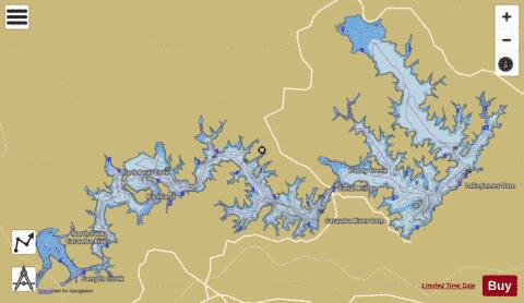
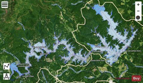
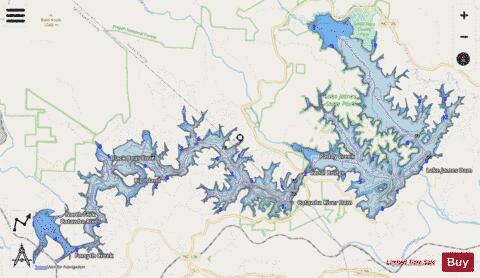
James Lake Fishing Map Stats | |
| Title | James Lake |
| Scale | 1:12000 |
| Counties | Burke, McDowell |
| Nearby Cities | Marion, Glen Alpine, West Marion, Woodlawn, Glenwood, Morganton, Salem, Spruce Pine, Old Fort, Collettsville |
| Area * | 6036.90 acres |
| Shoreline * | 128.59 miles |
| Min Longitude | -82.00 |
| Min Latitude | 35.71 |
| Max Longitude | -81.82 |
| Max Latitude | 35.80 |
| Edition Label 1 | |
| Edition Label 2 | |
| Edition Label 3 | |
| Id | US_AA_NC_james_lake_nc |
| Country | US |
| Projection | Mercator |
| * some Stats may include nearby/connecting waterbodies | |
|