Shearon Harris Reservoir fishing map is available as part of iBoating : USA Marine & Fishing App(now supported on multiple platforms including Android, iPhone/iPad, MacBook, and Windows(tablet and phone)/PC based chartplotter.).
With our Lake Maps App, you get all the great marine chart app features like fishing spots, along with Shearon Harris Reservoir depth map. The fishing maps app include HD lake depth contours, along with advanced features found in Fish Finder / Gps Chart Plotter systems, turning your device into a Depth Finder. The Shearon Harris Reservoir Navigation App provides advanced features of a Marine Chartplotter including adjusting water level offset and custom depth shading. Fishing spots and depth contours layers are available in most Lake maps. Lake navigation features include advanced instrumentation to gather wind speed direction, water temperature, water depth, and accurate GPS with AIS receivers(using NMEA over TCP/UDP). Autopilot support can be enabled during ‘Goto WayPoint’ and ‘Route Assistance’.
Now i-Boating supports Fishing Points in Shearon Harris Reservoir.
Have more questions about the Nautical Chart App? Ask us.
Fishing Info for Shearon Harris Reservoir
Harris Lake, or Shearon Harris Reservoir, is a reservoir in New Hill, North Carolina. The lake covers 4,100 acres (17 km2) in southwestern Wake County and southeastern Chatham County, located 220 feet above sea level. It is the source and outlet of cooling water for the Shearon Harris nuclear power plant. The lake is adjacent but not connected to B. Everett Jordan Lake. It was created by impounding Buckhorn Creek. There are two public boat ramps; one is near the southern end off North Carolina Highway 42, and the other near the northern end by Avent Ferry Road. Harris Lake County Park is located on the northeastern section of the lake. The park was leased to Wake County by Duke Energy in 1985, and opened to the public in 1999. The 680-acre park features five miles of hiking trails, almost eight miles of bike trails, and other amenities including picnic areas, a fishing pier, and a disc golf course. The park is home to several historic sites from an agricultural community, including the remains of the Womble, Smith, and Holleman households. The park also protects valuable Longleaf Pine forests.
More on Wikipedia...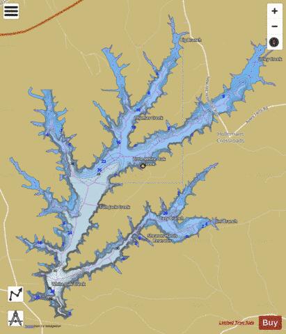
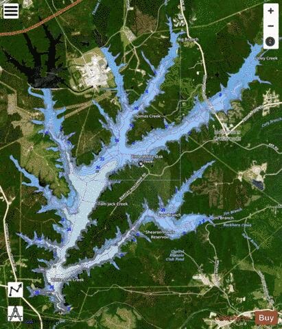
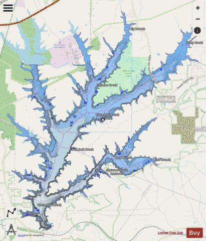
Shearon Harris Reservoir Fishing Map Stats | |
| Title | Shearon Harris Reservoir |
| Scale | 1:24000 |
| Counties | Chatham, Wake |
| Nearby Cities | Holly Springs, Haywood, Moncure, Apex, Fuquay-Varina, Broadway, Mamers, Colon, Cary, Morrisville |
| Area * | 3769.92 acres |
| Shoreline * | 81.21 miles |
| Min Longitude | -78.98 |
| Min Latitude | 35.57 |
| Max Longitude | -78.89 |
| Max Latitude | 35.65 |
| Edition Label 1 | |
| Edition Label 2 | |
| Edition Label 3 | |
| Id | US_AA_NC_01024879 |
| Country | US |
| Projection | Mercator |
| * some Stats may include nearby/connecting waterbodies | |
|