Lake Bernard Frank fishing map is available as part of iBoating : USA Marine & Fishing App(now supported on multiple platforms including Android, iPhone/iPad, MacBook, and Windows(tablet and phone)/PC based chartplotter.).
With our Lake Maps App, you get all the great marine chart app features like fishing spots, along with Lake Bernard Frank depth map. The fishing maps app include HD lake depth contours, along with advanced features found in Fish Finder / Gps Chart Plotter systems, turning your device into a Depth Finder. The Lake Bernard Frank Navigation App provides advanced features of a Marine Chartplotter including adjusting water level offset and custom depth shading. Fishing spots and depth contours layers are available in most Lake maps. Lake navigation features include advanced instrumentation to gather wind speed direction, water temperature, water depth, and accurate GPS with AIS receivers(using NMEA over TCP/UDP). Autopilot support can be enabled during ‘Goto WayPoint’ and ‘Route Assistance’.
Now i-Boating supports Fishing Points in Lake Bernard Frank.
Have more questions about the Nautical Chart App? Ask us.
Fishing Info for Lake Bernard Frank
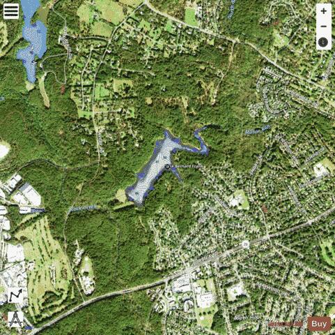
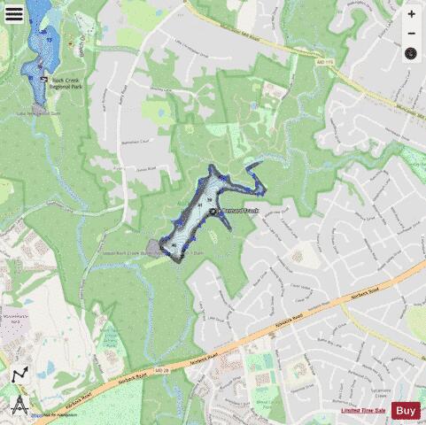
Lake Bernard Frank (also Lake Frank), is a 54-acre (220,000 m2) reservoir on the North Branch of Rock Creek in Derwood, Maryland, U.S., just east of Rockville. In the late 1960s it was renamed after Bernard Frank, a wilderness activist and a co-founder of The Wilderness Society. The lake's boundaries are, approximately, Route 28, East Gude Drive, Avery Road, and Muncaster Mill Road. Lake Frank was created in 1966 as Lake Norbeck to aid in flood and sediment control, as well as to provide recreation. It has an earthen dam, installed in 1967, on its southern side. It was created as a sister lake to Lake Needwood. Lake Frank is owned by the Maryland-National Capital Park and Planning Commission (M–NCPPC). The lake's secluded location within Rock Creek Regional Park is another of its assets. Visitors to the lake must bike or walk about 1/4 of a mile from all parking lots to get to the lakeshore. The Lake Frank & Meadowside Trails surround the lake, making it a favorite hiking spot. Also, locals enjoy fishing from the shoreline, though a license is needed to do so. However, swimming, boating, and ice skating are prohibited. The main trail around Lake Frank, the Lakeside Trail, is a 31⁄4 mile long loop. Approximately 2/3 of the trail is unpaved and traverses the woods surrounding the lake. The other part of the trail is wider and paved. At the approximate half-way point of the trail, there is a creek that must be crossed. Though there are a group of rocks which form a bridge-like path across, the creek may be impassable depending on the water level.
More on Wikipedia...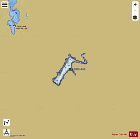
Lake Bernard Frank Fishing Map Stats | |
| Title | Lake Bernard Frank |
| Scale | 1:3000 |
| Counties | Montgomery |
| Nearby Cities | Norbeck, Rossmoor, Rockville, Aspen Hill, Derwood, Redland, Olney, Layhill, Washington Grove, Garrett Park |
| Area * | 51.60 acres |
| Shoreline * | 2.49 miles |
| Min Longitude | -77.12 |
| Min Latitude | 39.10 |
| Max Longitude | -77.11 |
| Max Latitude | 39.11 |
| Edition Label 1 | |
| Edition Label 2 | |
| Edition Label 3 | |
| Id | US_AA_MD_lake_bernard_frank_md |
| Country | US |
| Projection | Mercator |
| * some Stats may include nearby/connecting waterbodies | |
|