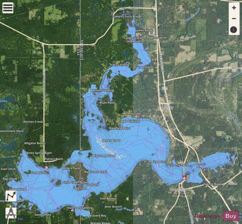
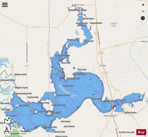
Caddo Lake fishing map is available as part of iBoating : USA Marine & Fishing App(now supported on multiple platforms including Android, iPhone/iPad, MacBook, and Windows(tablet and phone)/PC based chartplotter.).
With our Lake Maps App, you get all the great marine chart app features like fishing spots, along with Caddo Lake depth map. The fishing maps app include HD lake depth contours, along with advanced features found in Fish Finder / Gps Chart Plotter systems, turning your device into a Depth Finder. The Caddo Lake Navigation App provides advanced features of a Marine Chartplotter including adjusting water level offset and custom depth shading. Fishing spots and depth contours layers are available in most Lake maps. Lake navigation features include advanced instrumentation to gather wind speed direction, water temperature, water depth, and accurate GPS with AIS receivers(using NMEA over TCP/UDP). Autopilot support can be enabled during ‘Goto WayPoint’ and ‘Route Assistance’.
Now i-Boating supports Fishing Points in Caddo Lake.
Have more questions about the Nautical Chart App? Ask us.
Fishing Info for Caddo Lake
Caddo Lake (French: Lac Caddo) is a 25,400-acre (10,300 ha) lake and bayou (wetland) on the border between Texas and Louisiana, in northern Harrison County and southern Marion County in Texas and western Caddo Parish in Louisiana. The lake is named after the Southeastern culture of Native Americans called Caddoans or Caddo, who lived in the area until their expulsion in the 19th century. It is an internationally protected wetland under the Ramsar Convention and includes one of the largest flooded cypress forests in the United States. Caddo is one of Texas's few non-oxbow natural lakes and is the second-largest in the South; however, it was artificially altered by the addition of a dam in the 1900s.
More on Wikipedia...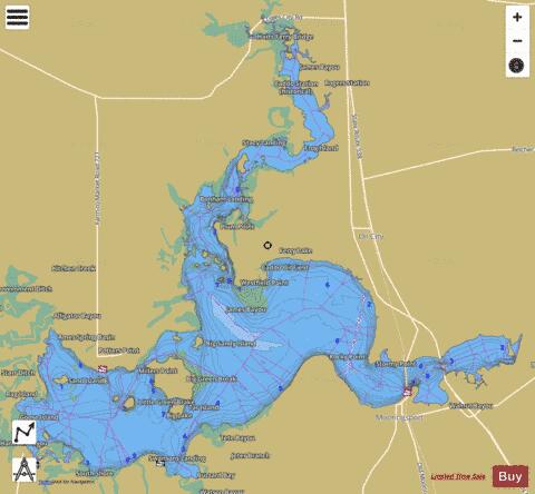
Caddo Lake Fishing Map Stats | |
| Title | Caddo Lake |
| Scale | 1:24000 |
| Counties | Caddo, Harrison, Marion |
| Nearby Cities | Mooringsport, Oil City, Uncertain, Gray, Vivian, Karnack, Leigh, Belcher, Blanchard, Smithland |
| Area * | 15054.18 acres |
| Shoreline * | 110.08 miles |
| Min Longitude | -94.10 |
| Min Latitude | 32.67 |
| Max Longitude | -93.92 |
| Max Latitude | 32.81 |
| Edition Label 1 | |
| Edition Label 2 | |
| Edition Label 3 | |
| Id | US_AA_LA_00553850 |
| Country | US |
| Projection | Mercator |
| * some Stats may include nearby/connecting waterbodies | |
|