Lake Carroll fishing map is available as part of iBoating : USA Marine & Fishing App(now supported on multiple platforms including Android, iPhone/iPad, MacBook, and Windows(tablet and phone)/PC based chartplotter.).
With our Lake Maps App, you get all the great marine chart app features like fishing spots, along with Lake Carroll depth map. The fishing maps app include HD lake depth contours, along with advanced features found in Fish Finder / Gps Chart Plotter systems, turning your device into a Depth Finder. The Lake Carroll Navigation App provides advanced features of a Marine Chartplotter including adjusting water level offset and custom depth shading. Fishing spots and depth contours layers are available in most Lake maps. Lake navigation features include advanced instrumentation to gather wind speed direction, water temperature, water depth, and accurate GPS with AIS receivers(using NMEA over TCP/UDP). Autopilot support can be enabled during ‘Goto WayPoint’ and ‘Route Assistance’.
Now i-Boating supports Fishing Points in Lake Carroll.
Have more questions about the Nautical Chart App? Ask us.
Fishing Info for Lake Carroll
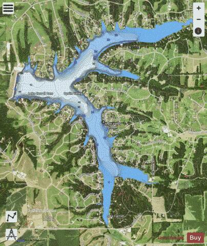
Lake Carroll is a man-made recreational lake located in Carroll County, Illinois. It was formed in 1974 by the damming of the east fork of the Plum River near the town of Lanark, Illinois. The earthen dam is owned and operated by the Lake Carroll Association. It is the largest private lake in the state of Illinois. Access to the lake is permitted only to members of the Lake Carroll Association, which is composed of the owners of property both on and off the lake. The community surrounding the lake is the Lake Carroll census-designated place.
More on Wikipedia...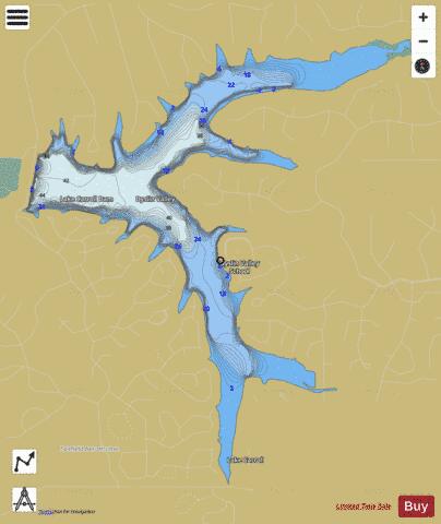
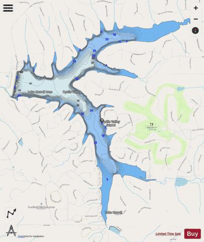
Lake Carroll Fishing Map Stats | |
| Title | Lake Carroll |
| Scale | 1:12000 |
| Counties | Carroll |
| Nearby Cities | Lanark, Pearl City, Shannon, Mount Carroll, Chadwick, Lena, Florence, Stockton, Milledgeville, Freeport |
| Area * | 605.98 acres |
| Shoreline * | 14.71 miles |
| Min Longitude | -89.89 |
| Min Latitude | 42.16 |
| Max Longitude | -89.85 |
| Max Latitude | 42.19 |
| Edition Label 1 | |
| Edition Label 2 | |
| Edition Label 3 | |
| Id | US_AA_IL_lake_carroll_il |
| Country | US |
| Projection | Mercator |
| * some Stats may include nearby/connecting waterbodies | |
|