Lake Decatur fishing map is available as part of iBoating : USA Marine & Fishing App(now supported on multiple platforms including Android, iPhone/iPad, MacBook, and Windows(tablet and phone)/PC based chartplotter.).
With our Lake Maps App, you get all the great marine chart app features like fishing spots, along with Lake Decatur depth map. The fishing maps app include HD lake depth contours, along with advanced features found in Fish Finder / Gps Chart Plotter systems, turning your device into a Depth Finder. The Lake Decatur Navigation App provides advanced features of a Marine Chartplotter including adjusting water level offset and custom depth shading. Fishing spots and depth contours layers are available in most Lake maps. Lake navigation features include advanced instrumentation to gather wind speed direction, water temperature, water depth, and accurate GPS with AIS receivers(using NMEA over TCP/UDP). Autopilot support can be enabled during ‘Goto WayPoint’ and ‘Route Assistance’.
Now i-Boating supports Fishing Points in Lake Decatur.
Have more questions about the Nautical Chart App? Ask us.
Fishing Info for Lake Decatur
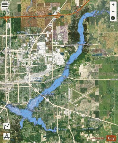
Lake Decatur is a 2,800-acre (11 km2) reservoir located in the city of Decatur, Illinois, USA, east of downtown. The city and lake both share the name of U.S. Navy Commodore Stephen Decatur. The lake is 613 feet (187 m) above sea level and has a watershed of 925 square miles (2,400 km2) or 592,000 acres (240,000 ha) reaching into parts of seven counties. The largest lake on the Sangamon River, it was created in 1920–1922.
More on Wikipedia...Popular fish species in this lake include Crappie and Walleye.
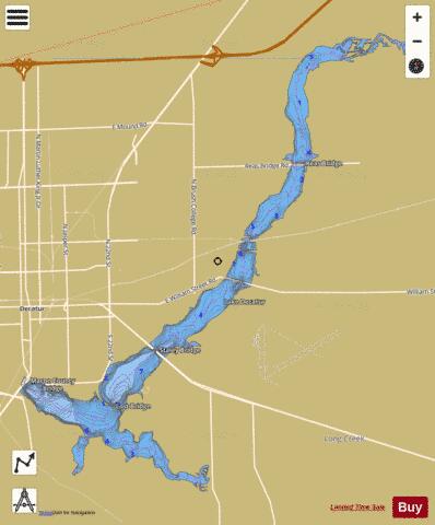
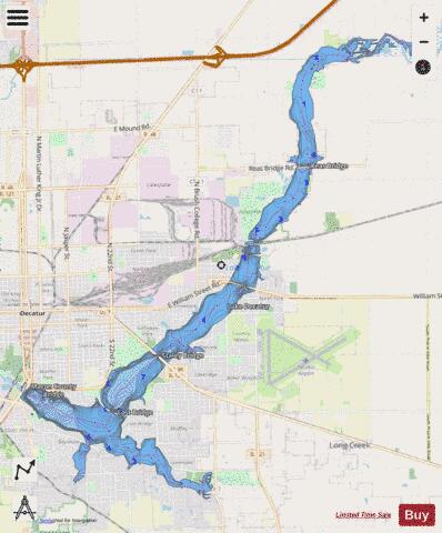
Lake Decatur Fishing Map Stats | |
| Title | Lake Decatur |
| Scale | 1:24000 |
| Counties | Macon |
| Nearby Cities | Decatur, Oreana, Mount Zion, Oakley, Long Creek, Argenta, Forsyth, Cerro Gordo, Macon, Boody |
| Area * | 2904.56 acres |
| Shoreline * | 52.51 miles |
| Min Longitude | -88.96 |
| Min Latitude | 39.80 |
| Max Longitude | -88.82 |
| Max Latitude | 39.92 |
| Edition Label 1 | |
| Edition Label 2 | |
| Edition Label 3 | |
| Id | US_AA_IL_00407046 |
| Country | US |
| Projection | Mercator |
| * some Stats may include nearby/connecting waterbodies | |
|