Stanley Lake fishing map is available as part of iBoating : USA Marine & Fishing App(now supported on multiple platforms including Android, iPhone/iPad, MacBook, and Windows(tablet and phone)/PC based chartplotter.).
With our Lake Maps App, you get all the great marine chart app features like fishing spots, along with Stanley Lake depth map. The fishing maps app include HD lake depth contours, along with advanced features found in Fish Finder / Gps Chart Plotter systems, turning your device into a Depth Finder. The Stanley Lake Navigation App provides advanced features of a Marine Chartplotter including adjusting water level offset and custom depth shading. Fishing spots and depth contours layers are available in most Lake maps. Lake navigation features include advanced instrumentation to gather wind speed direction, water temperature, water depth, and accurate GPS with AIS receivers(using NMEA over TCP/UDP). Autopilot support can be enabled during ‘Goto WayPoint’ and ‘Route Assistance’.
Now i-Boating supports Fishing Points in Stanley Lake.
Have more questions about the Nautical Chart App? Ask us.
Fishing Info for Stanley Lake
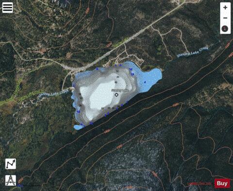
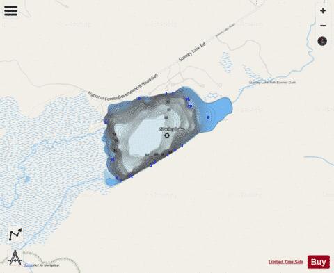
Stanley Lake is an alpine lake in the western United States, located in Custer County, Idaho, at the base of the Sawtooth Mountains in the Sawtooth National Recreation Area. The lake is approximately seven miles (11 km) west of Stanley, readily accessed via a three-mile (5 km) spur road from State Highway 21. The surface elevation of the lake is 6,513 feet (1,985 m) above sea level. Stanley Lake is northeast of the base of the 9,860-foot (3,005 m) McGown Peak, and just south of the considerably smaller Elk Peak. The lake is two miles (3 km) downstream of Lady Face Falls on Stanley Lake Creek; it drains into the main Salmon River via Stanley Lake Creek and Valley Creek. Recreational facilities at the lake include three campgrounds with nightly fees, a day use area, a boat launch, and hiking trails. * Stanley Lake * Mountains Behind Stanley Lake * Wetlands Behind Stanley Lake
More on Wikipedia...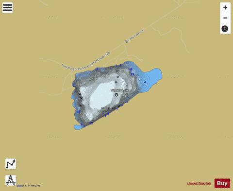
Stanley Lake Fishing Map Stats | |
| Title | Stanley Lake |
| Scale | 1:3000 |
| Counties | Custer |
| Nearby Cities | Stanley, Sunbeam, Atlanta, Lowman, Clayton, Featherville, Pine, Yellow Pine, Challis, Idaho City |
| Area * | 180.09 acres |
| Shoreline * | 2.52 miles |
| Min Longitude | -115.06 |
| Min Latitude | 44.24 |
| Max Longitude | -115.05 |
| Max Latitude | 44.25 |
| Edition Label 1 | |
| Edition Label 2 | |
| Edition Label 3 | |
| Id | US_AA_ID_stanley_lake_id |
| Country | US |
| Projection | Mercator |
| * some Stats may include nearby/connecting waterbodies | |
|