Hoopes Reservoir fishing map is available as part of iBoating : USA Marine & Fishing App(now supported on multiple platforms including Android, iPhone/iPad, MacBook, and Windows(tablet and phone)/PC based chartplotter.).
With our Lake Maps App, you get all the great marine chart app features like fishing spots, along with Hoopes Reservoir depth map. The fishing maps app include HD lake depth contours, along with advanced features found in Fish Finder / Gps Chart Plotter systems, turning your device into a Depth Finder. The Hoopes Reservoir Navigation App provides advanced features of a Marine Chartplotter including adjusting water level offset and custom depth shading. Fishing spots and depth contours layers are available in most Lake maps. Lake navigation features include advanced instrumentation to gather wind speed direction, water temperature, water depth, and accurate GPS with AIS receivers(using NMEA over TCP/UDP). Autopilot support can be enabled during ‘Goto WayPoint’ and ‘Route Assistance’.
Now i-Boating supports Fishing Points in Hoopes Reservoir.
Have more questions about the Nautical Chart App? Ask us.
Fishing Info for Hoopes Reservoir
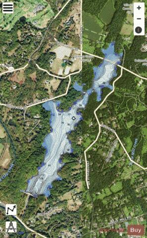
Hoopes Reservoir is a reservoir in New Castle County, Delaware. The reservoir first impounded the water of Old Mill Stream and Red Clay Creek in 1932, with a dam built by the city of Wilmington, Delaware, for municipal drinking water. It has a water surface of 187 acres, a maximum capacity of 11,000 acre-feet, and a normal capacity of 6300 acre-feet. The reservoir and its surroundings have been open to the public since 1971. It is the largest reservoir in Delaware. The dam, Edgar M. Hoopes Dam (National ID # DE00015), is a concrete gravity dam originally built in 1932 and restructured several times since. It is 135 feet high and 845 feet in length at the crest. Its namesake, Edgar M. Hoopes, was Chief Engineer of the Wilmington Water Department from 1913 through 1918, according to a plaque on site.
More on Wikipedia...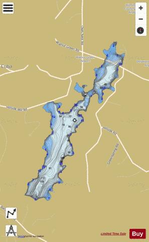
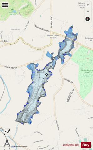
Hoopes Reservoir Fishing Map Stats | |
| Title | Hoopes Reservoir |
| Scale | 1:6000 |
| Counties | New Castle |
| Nearby Cities | Greenville, Centerville, Montchanin, Westover Hills, Rockland, Elsmere, Yorklyn, Fairville, Marshallton, Stanton |
| Area * | 187.86 acres |
| Shoreline * | 5.69 miles |
| Min Longitude | -75.64 |
| Min Latitude | 39.77 |
| Max Longitude | -75.62 |
| Max Latitude | 39.79 |
| Edition Label 1 | |
| Edition Label 2 | |
| Edition Label 3 | |
| Id | US_AA_DE_hoopes_reservoir_de |
| Country | US |
| Projection | Mercator |
| * some Stats may include nearby/connecting waterbodies | |
|