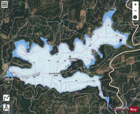
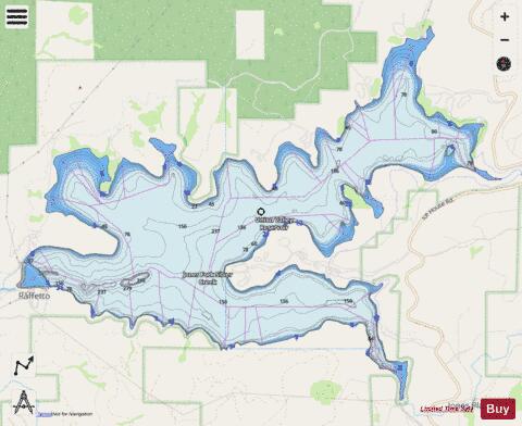
Union Valley Reservoir fishing map is available as part of iBoating : USA Marine & Fishing App(now supported on multiple platforms including Android, iPhone/iPad, MacBook, and Windows(tablet and phone)/PC based chartplotter.).
With our Lake Maps App, you get all the great marine chart app features like fishing spots, along with Union Valley Reservoir depth map. The fishing maps app include HD lake depth contours, along with advanced features found in Fish Finder / Gps Chart Plotter systems, turning your device into a Depth Finder. The Union Valley Reservoir Navigation App provides advanced features of a Marine Chartplotter including adjusting water level offset and custom depth shading. Fishing spots and depth contours layers are available in most Lake maps. Lake navigation features include advanced instrumentation to gather wind speed direction, water temperature, water depth, and accurate GPS with AIS receivers(using NMEA over TCP/UDP). Autopilot support can be enabled during ‘Goto WayPoint’ and ‘Route Assistance’.
Now i-Boating supports Fishing Points in Union Valley Reservoir.
Have more questions about the Nautical Chart App? Ask us.
Fishing Info for Union Valley Reservoir
Union Valley Reservoir is a reservoir in eastern El Dorado County, California, about 20 miles (32 km) northeast of Placerville. The 277,000 acre-feet (342,000,000 m3) lake is in Eldorado National Forest in the Sierra Nevada at an elevation of 4,870 feet (1,480 m). It was formed in 1963 by the 453-foot (138 m) high earth and rockfill Union Valley Dam on Silver Creek, which is a tributary of the American River. The reservoir is part of the Upper American River Project of the Sacramento Municipal Utility District, a public electric utility, which operates the dam and many other dams in the area. Recreation such as boating, fishing and camping is available there. It stores snow melt runoff during the spring and releases it during the summer when electrical demand is greatest to a chain of hydroelectric power plants downstream. Union Valley Powerhouse at the base of the dam has a capacity of 46.7 MW and is operated as a peaking power plant, supplying electricity during times of the greatest demand. Consumptive rights to the water itself are held by the City of Sacramento, California. The reservoir is fed by Big Silver Creek, Jones Fork Silver Creek, Tells Creek, Wench Creek and the outflows of Robbs Peak and Jones Fork powerhouses. Jones Fork Powerhouse is not on Jones Fork Silver Creek but instead conveys water from Ice House Reservoir. Robbs Peak Powerhouse gets its water from the Middle Fork American River headwaters, by way of Loon Lake Reservoir, and small reservoirs on Gerle Creek and South Fork Rubicon River. Downstream from Union Valley Dam, Silver Creek waters are largely diverted through two additional powerhouses below small reservoirs before joining the South Fork American River a few miles north of Pollock Pines, California. Silver Creek was an intermittent creek before the development of Union Valley Reservoir and the diversions from the Middle Fork American River.
More on Wikipedia...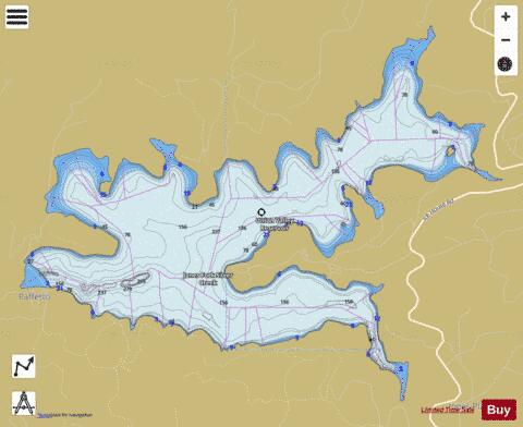
Union Valley Reservoir Fishing Map Stats | |
| Title | Union Valley Reservoir |
| Scale | 1:24000 |
| Counties | El Dorado |
| Nearby Cities | Kyburz, Pollock Pines, Grizzly Flats, Camino, Meeks Bay, Tahoma, Omo Ranch, Kirkwood, Tahoe City, Placerville |
| Area * | 2754.38 acres |
| Shoreline * | 25.10 miles |
| Min Longitude | -120.44 |
| Min Latitude | 38.85 |
| Max Longitude | -120.37 |
| Max Latitude | 38.90 |
| Edition Label 1 | |
| Edition Label 2 | |
| Edition Label 3 | |
| Id | US_AA_CA_union_valley_ca |
| Country | US |
| Projection | Mercator |
| * some Stats may include nearby/connecting waterbodies | |
|