Lake Thomas A Edison fishing map is available as part of iBoating : USA Marine & Fishing App(now supported on multiple platforms including Android, iPhone/iPad, MacBook, and Windows(tablet and phone)/PC based chartplotter.).
With our Lake Maps App, you get all the great marine chart app features like fishing spots, along with Lake Thomas A Edison depth map. The fishing maps app include HD lake depth contours, along with advanced features found in Fish Finder / Gps Chart Plotter systems, turning your device into a Depth Finder. The Lake Thomas A Edison Navigation App provides advanced features of a Marine Chartplotter including adjusting water level offset and custom depth shading. Fishing spots and depth contours layers are available in most Lake maps. Lake navigation features include advanced instrumentation to gather wind speed direction, water temperature, water depth, and accurate GPS with AIS receivers(using NMEA over TCP/UDP). Autopilot support can be enabled during ‘Goto WayPoint’ and ‘Route Assistance’.
Now i-Boating supports Fishing Points in Lake Thomas A Edison.
Have more questions about the Nautical Chart App? Ask us.
Fishing Info for Lake Thomas A Edison
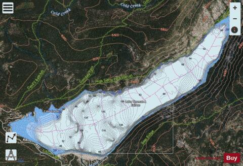
Lake Thomas A Edison (also known as Thomas A. Edison Lake and Edison Lake) is a reservoir in the Sierra National Forest and in Fresno County, California. It is in the Sierra Nevada, and near the Pacific Crest Trail. The reservoir's waters are impounded by Vermilion Valley Dam (National ID CA00441), which was completed in 1954. The reservoir and dam are part of the Big Creek Hydroelectric Project.
More on Wikipedia...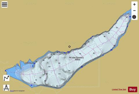
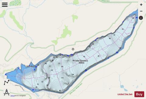
Lake Thomas A Edison Fishing Map Stats | |
| Title | Lake Thomas A Edison |
| Scale | 1:12000 |
| Counties | Fresno |
| Nearby Cities | Lakeshore, Mammoth Lakes, Aspen Springs, Big Creek, Toms Place, Paradise, Round Valley, June Lake, Shaver Lake, Pineridge |
| Area * | 1835.47 acres |
| Shoreline * | 11.02 miles |
| Min Longitude | -119.01 |
| Min Latitude | 37.37 |
| Max Longitude | -118.94 |
| Max Latitude | 37.41 |
| Edition Label 1 | |
| Edition Label 2 | |
| Edition Label 3 | |
| Id | US_AA_CA_thomas_edison_lake_ca |
| Country | US |
| Projection | Mercator |
| * some Stats may include nearby/connecting waterbodies | |
|