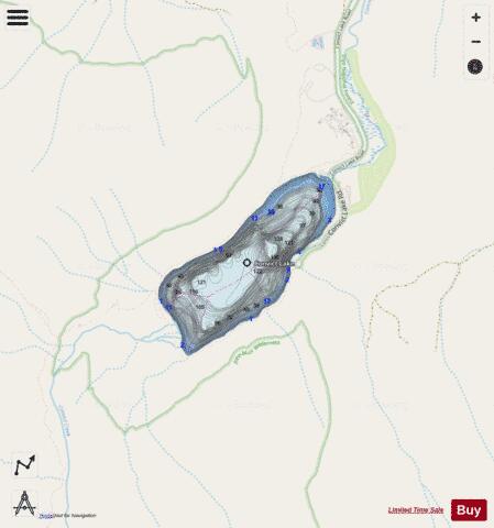
Convict Lake fishing map is available as part of iBoating : USA Marine & Fishing App(now supported on multiple platforms including Android, iPhone/iPad, MacBook, and Windows(tablet and phone)/PC based chartplotter.).
With our Lake Maps App, you get all the great marine chart app features like fishing spots, along with Convict Lake depth map. The fishing maps app include HD lake depth contours, along with advanced features found in Fish Finder / Gps Chart Plotter systems, turning your device into a Depth Finder. The Convict Lake Navigation App provides advanced features of a Marine Chartplotter including adjusting water level offset and custom depth shading. Fishing spots and depth contours layers are available in most Lake maps. Lake navigation features include advanced instrumentation to gather wind speed direction, water temperature, water depth, and accurate GPS with AIS receivers(using NMEA over TCP/UDP). Autopilot support can be enabled during ‘Goto WayPoint’ and ‘Route Assistance’.
Now i-Boating supports Fishing Points in Convict Lake.
Have more questions about the Nautical Chart App? Ask us.
Fishing Info for Convict Lake
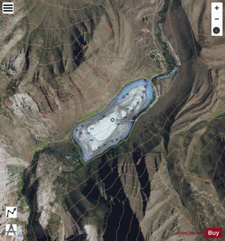
Convict Lake (Mono: Wit-sa-nap) is a lake located in Mono County, California, United States, situated in the Sherwin Range of the Sierra Nevada. It is known for its turquoise-blue water, the dramatic mountains (including Mount Morrison) that surround it, the trout fishing it affords, and its unusual history. The lake was renamed from its traditional Mono name by American settlers after an incident on September 23, 1871, in which a group of convicts escaped from prison in Carson City, Nevada, and took refuge near the lake. They were pursued by a posse, and after it caught up to the convicts, a shootout followed, in which a number of both posse members and convicts were killed or wounded. The remaining convicts who survived initially escaped but were eventually captured to be taken back to prison but were lynched instead.
More on Wikipedia...Popular fish species in this lake include Rainbow trout.
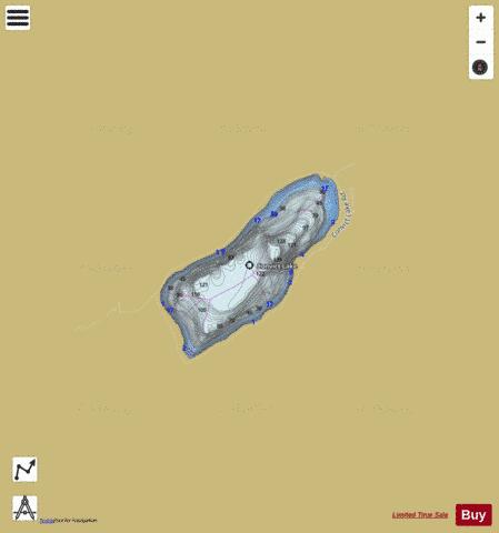
Convict Lake Fishing Map Stats | |
| Title | Convict Lake |
| Scale | 1:3000 |
| Counties | Mono |
| Nearby Cities | Mammoth Lakes, Aspen Springs, Toms Place, Paradise, June Lake, Round Valley, Benton, Lee Vining, Lakeshore, Chalfant |
| Area * | 171.86 acres |
| Shoreline * | 2.44 miles |
| Min Longitude | -118.87 |
| Min Latitude | 37.58 |
| Max Longitude | -118.85 |
| Max Latitude | 37.59 |
| Edition Label 1 | |
| Edition Label 2 | |
| Edition Label 3 | |
| Id | US_AA_CA_convict_lake_ca |
| Country | US |
| Projection | Mercator |
| * some Stats may include nearby/connecting waterbodies | |
|