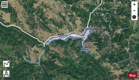
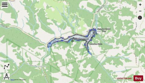
Almaden Reservoir fishing map is available as part of iBoating : USA Marine & Fishing App(now supported on multiple platforms including Android, iPhone/iPad, MacBook, and Windows(tablet and phone)/PC based chartplotter.).
With our Lake Maps App, you get all the great marine chart app features like fishing spots, along with Almaden Reservoir depth map. The fishing maps app include HD lake depth contours, along with advanced features found in Fish Finder / Gps Chart Plotter systems, turning your device into a Depth Finder. The Almaden Reservoir Navigation App provides advanced features of a Marine Chartplotter including adjusting water level offset and custom depth shading. Fishing spots and depth contours layers are available in most Lake maps. Lake navigation features include advanced instrumentation to gather wind speed direction, water temperature, water depth, and accurate GPS with AIS receivers(using NMEA over TCP/UDP). Autopilot support can be enabled during ‘Goto WayPoint’ and ‘Route Assistance’.
Now i-Boating supports Fishing Points in Almaden Reservoir.
Have more questions about the Nautical Chart App? Ask us.
Fishing Info for Almaden Reservoir
Almaden Reservoir is an artificial lake in the hills south of San Jose, California in the United States. It borders on the 4,163-acre (1,685 ha) Almaden Quicksilver County Park, which provides limited fishing ("catch-and-release"), picnicking, hiking, and horseback riding activities. Swimming and boating are not permitted in the reservoir. The California Office of Environmental Health Hazard Assessment has issued a "Do Not Eat" advisory for any fish caught in Almaden Reservoir due to elevated levels of mercury.
More on Wikipedia...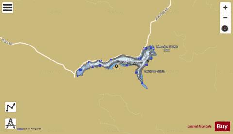
Almaden Reservoir Fishing Map Stats | |
| Title | Almaden Reservoir |
| Scale | 1:3000 |
| Counties | Santa Clara |
| Nearby Cities | Cambrian Park, Los Gatos, Campbell, Monte Sereno, Corralitos, Morgan Hill, San Jose, Aptos, Alum Rock, Scotts Valley |
| Area * | 52.50 acres |
| Shoreline * | 2.62 miles |
| Min Longitude | -121.84 |
| Min Latitude | 37.16 |
| Max Longitude | -121.83 |
| Max Latitude | 37.17 |
| Edition Label 1 | |
| Edition Label 2 | |
| Edition Label 3 | |
| Id | US_AA_CA_almaden_reservoir__ca |
| Country | US |
| Projection | Mercator |
| * some Stats may include nearby/connecting waterbodies | |
|