Canyon Lake/Mormon Flat fishing map is available as part of iBoating : USA Marine & Fishing App(now supported on multiple platforms including Android, iPhone/iPad, MacBook, and Windows(tablet and phone)/PC based chartplotter.).
With our Lake Maps App, you get all the great marine chart app features like fishing spots, along with Canyon Lake/Mormon Flat depth map. The fishing maps app include HD lake depth contours, along with advanced features found in Fish Finder / Gps Chart Plotter systems, turning your device into a Depth Finder. The Canyon Lake/Mormon Flat Navigation App provides advanced features of a Marine Chartplotter including adjusting water level offset and custom depth shading. Fishing spots and depth contours layers are available in most Lake maps. Lake navigation features include advanced instrumentation to gather wind speed direction, water temperature, water depth, and accurate GPS with AIS receivers(using NMEA over TCP/UDP). Autopilot support can be enabled during ‘Goto WayPoint’ and ‘Route Assistance’.
Now i-Boating supports Fishing Points in Canyon Lake/Mormon Flat.
Have more questions about the Nautical Chart App? Ask us.
Fishing Info for Canyon Lake/Mormon Flat
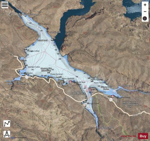
Canyon Lake is one of four reservoirs that were formed by the damming of the Salt River in the U.S. state of Arizona as part of the Salt River Project. It was formed by the Mormon Flat Dam, which was completed in 1925 after two years of construction. Canyon Lake, with a surface area of 950 acres (380 ha), is the third and smallest of the four lakes created along the river. Two others, Apache Lake and Roosevelt Lake, are upstream. The fourth, Saguaro Lake, is downstream. Canyon Lake lies approximately 15 miles (24 km) up the Apache Trail from Apache Junction, Arizona and 51 miles (82 km) east of Phoenix. It is within the Superstition Wilderness of Tonto National Forest and is a popular recreation area for the Phoenix metropolitan area. Recreation amenities include hiking trails, camping, and boating, all managed by the United States Forest Service. Canyon Lake is a popular stop along the Apache Trail (Arizona State Route 88) from Apache Junction, Arizona, passing Tortilla Flat, Arizona, before reaching Apache Lake and Roosevelt Lake behind Theodore Roosevelt Dam. 2022 fish kill has been caused by golden algae.
More on Wikipedia...Popular fish species in this lake include Crappie and Walleye.
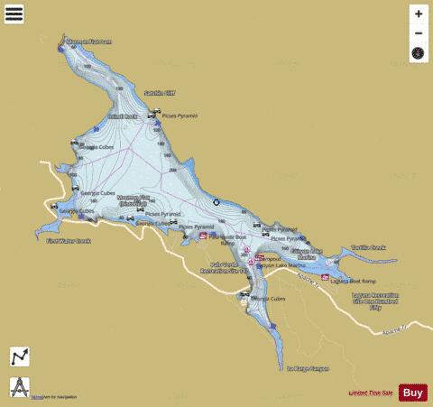
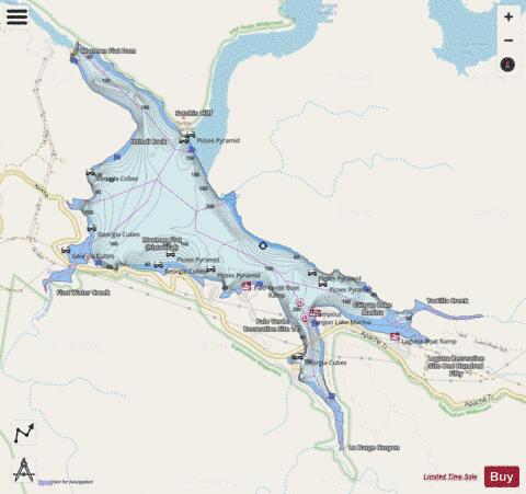
Canyon Lake/Mormon Flat Fishing Map Stats | |
| Title | Canyon Lake/Mormon Flat |
| Scale | 1:12000 |
| Counties | Maricopa |
| Nearby Cities | Tortilla Flat, Apache Junction, Gold Canyon, Queen Valley, Florence Junction, Fountain Hills, Rio Verde, Roosevelt, Sunflower, Tonto Basin |
| Area * | 453.03 acres |
| Shoreline * | 9.11 miles |
| Min Longitude | -111.45 |
| Min Latitude | 33.53 |
| Max Longitude | -111.41 |
| Max Latitude | 33.55 |
| Edition Label 1 | |
| Edition Label 2 | |
| Edition Label 3 | |
| Id | US_AA_AZ_00037040 |
| Country | US |
| Projection | Mercator |
| * some Stats may include nearby/connecting waterbodies | |
|