Finger Lake fishing map is available as part of iBoating : USA Marine & Fishing App(now supported on multiple platforms including Android, iPhone/iPad, MacBook, and Windows(tablet and phone)/PC based chartplotter.).
With our Lake Maps App, you get all the great marine chart app features like fishing spots, along with Finger Lake depth map. The fishing maps app include HD lake depth contours, along with advanced features found in Fish Finder / Gps Chart Plotter systems, turning your device into a Depth Finder. The Finger Lake Navigation App provides advanced features of a Marine Chartplotter including adjusting water level offset and custom depth shading. Fishing spots and depth contours layers are available in most Lake maps. Lake navigation features include advanced instrumentation to gather wind speed direction, water temperature, water depth, and accurate GPS with AIS receivers(using NMEA over TCP/UDP). Autopilot support can be enabled during ‘Goto WayPoint’ and ‘Route Assistance’.
Now i-Boating supports Fishing Points in Finger Lake.
Have more questions about the Nautical Chart App? Ask us.
Fishing Info for Finger Lake
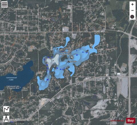
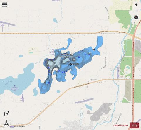
Finger Lake is a lake in Wasilla, Alaska. It is not technically a finger lake, but was named so by Captain Edward Glenn, who led an army expedition to Alaska in 1898 and felt that "when viewing the lake on a map, a point of land in the lake gives the impression of a finger." The lake has populations of Rainbow Trout, Arctic Char and Arctic Grayling and is a popular fishing spot, including ice fishing in winter. The lake is at the south end of the Seven-mile canoe trail that ends at Wasilla Lake, the only portage is at the north end of Finger Lake.
More on Wikipedia...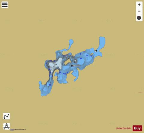
Finger Lake Fishing Map Stats | |
| Title | Finger Lake |
| Scale | 1:6000 |
| Counties | Matanuska-Susitna |
| Nearby Cities | Matanuska, Wasilla, Palmer, Butte, Chugiak, Cottonwood, Jonesville, Eska, Sutton, Eagle River |
| Area * | 351.62 acres |
| Shoreline * | 8.28 miles |
| Min Longitude | -149.30 |
| Min Latitude | 61.59 |
| Max Longitude | -149.26 |
| Max Latitude | 61.61 |
| Edition Label 1 | |
| Edition Label 2 | |
| Edition Label 3 | |
| Id | US_AA_AK_finger_lake_ak |
| Country | US |
| Projection | Mercator |
| * some Stats may include nearby/connecting waterbodies | |
|