Liberty Lake fishing map is available as part of iBoating : USA Marine & Fishing App(now supported on multiple platforms including Android, iPhone/iPad, MacBook, and Windows(tablet and phone)/PC based chartplotter.).
With our Lake Maps App, you get all the great marine chart app features like fishing spots, along with Liberty Lake depth map. The fishing maps app include HD lake depth contours, along with advanced features found in Fish Finder / Gps Chart Plotter systems, turning your device into a Depth Finder. The Liberty Lake Navigation App provides advanced features of a Marine Chartplotter including adjusting water level offset and custom depth shading. Fishing spots and depth contours layers are available in most Lake maps. Lake navigation features include advanced instrumentation to gather wind speed direction, water temperature, water depth, and accurate GPS with AIS receivers(using NMEA over TCP/UDP). Autopilot support can be enabled during ‘Goto WayPoint’ and ‘Route Assistance’.
Now i-Boating supports Fishing Points in Liberty Lake.
Have more questions about the Nautical Chart App? Ask us.
Fishing Info for Liberty Lake
Liberty Lake is a lake in Spokane County in the U.S. state of Washington. The lake is located about 800 feet (240 m) south of the eponymous city, and is a popular fishing spot. The lake is part of the Spokane Valley–Rathdrum Prairie Aquifer. Besides the aquifer, the only outflow is a small unnamed stream that ends at a small ephemeral pond a little over 1 mile (1.9 km) to the North.
More on Wikipedia...Popular fish species in this lake include Black crappie, Brown bullhead, Largemouth bass, Rainbow trout, Smallmouth bass, Walleye and Yellow perch.
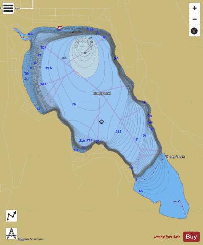
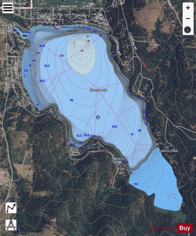
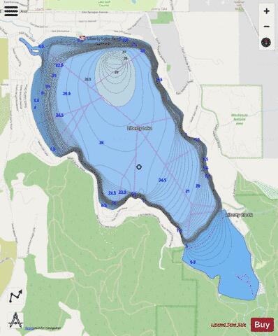
Liberty Lake Fishing Map Stats | |
| Title | Liberty Lake |
| Scale | 1:12000 |
| Counties | Spokane |
| Nearby Cities | Liberty Lake, Otis Orchards, East Farms, State Line, Veradale, Newman Lake, Trentwood, Hauser, Post Falls, Opportunity |
| Area * | 816.77 acres |
| Shoreline * | 6.30 miles |
| Min Longitude | -117.09 |
| Min Latitude | 47.63 |
| Max Longitude | -117.06 |
| Max Latitude | 47.65 |
| Edition Label 1 | |
| Edition Label 2 | |
| Edition Label 3 | |
| Id | US_WA_01506148 |
| Country | US |
| Projection | Mercator |
| * some Stats may include nearby/connecting waterbodies | |
|