Beaver Dam Lake fishing map is available as part of iBoating : USA Marine & Fishing App(now supported on multiple platforms including Android, iPhone/iPad, MacBook, and Windows(tablet and phone)/PC based chartplotter.).
With our Lake Maps App, you get all the great marine chart app features like fishing spots, along with Beaver Dam Lake depth map. The fishing maps app include HD lake depth contours, along with advanced features found in Fish Finder / Gps Chart Plotter systems, turning your device into a Depth Finder. The Beaver Dam Lake Navigation App provides advanced features of a Marine Chartplotter including adjusting water level offset and custom depth shading. Fishing spots and depth contours layers are available in most Lake maps. Lake navigation features include advanced instrumentation to gather wind speed direction, water temperature, water depth, and accurate GPS with AIS receivers(using NMEA over TCP/UDP). Autopilot support can be enabled during ‘Goto WayPoint’ and ‘Route Assistance’.
Now i-Boating supports Fishing Points in Beaver Dam Lake.
Have more questions about the Nautical Chart App? Ask us.
Fishing Info for Beaver Dam Lake
Beaver Dam Lake is a 6,718 acre lake in Dodge County, Wisconsin. The communities of Beaver Dam, South Beaver Dam, Sunset Beach, Beaver Edge, Fox Lake Junction border the lake. The fish present in the lake are Panfish, Largemouth Bass, Northern Pike, and Walleye. The lake is created by a dam located in the City of Beaver Dam at Haskell Street and flows into the Beaver Dam River. There are seven public boat landings and numerous parks along the lake shore. Water from Fox Lake flows through the Mill Creek into Beaver Dam Lake.
More on Wikipedia...Popular fish species in this lake include Walleye.
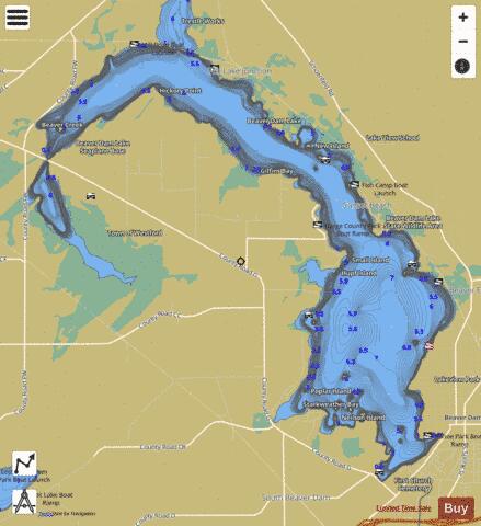
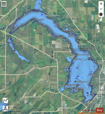
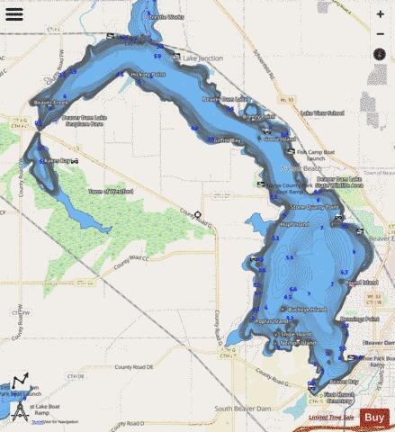
Beaver Dam Lake Fishing Map Stats | |
| Title | Beaver Dam Lake |
| Scale | 1:12000 |
| Counties | Dodge |
| Nearby Cities | Beaver Dam, Fox Lake, Randolph, Lowell, Oak Grove, Friesland, Astico, Burnett, Reeseville, Fall River |
| Area * | 6405.43 acres |
| Shoreline * | 42.34 miles |
| Min Longitude | -88.97 |
| Min Latitude | 43.44 |
| Max Longitude | -88.84 |
| Max Latitude | 43.54 |
| Edition Label 1 | |
| Edition Label 2 | |
| Edition Label 3 | |
| Id | US_UB_WI_01561480 |
| Country | US |
| Projection | Mercator |
| * some Stats may include nearby/connecting waterbodies | |
|