Lake Nanih Waiya fishing map is available as part of iBoating : USA Marine & Fishing App(now supported on multiple platforms including Android, iPhone/iPad, MacBook, and Windows(tablet and phone)/PC based chartplotter.).
With our Lake Maps App, you get all the great marine chart app features like fishing spots, along with Lake Nanih Waiya depth map. The fishing maps app include HD lake depth contours, along with advanced features found in Fish Finder / Gps Chart Plotter systems, turning your device into a Depth Finder. The Lake Nanih Waiya Navigation App provides advanced features of a Marine Chartplotter including adjusting water level offset and custom depth shading. Fishing spots and depth contours layers are available in most Lake maps. Lake navigation features include advanced instrumentation to gather wind speed direction, water temperature, water depth, and accurate GPS with AIS receivers(using NMEA over TCP/UDP). Autopilot support can be enabled during ‘Goto WayPoint’ and ‘Route Assistance’.
Now i-Boating supports Fishing Points in Lake Nanih Waiya.
Have more questions about the Nautical Chart App? Ask us.
Fishing Info for Lake Nanih Waiya
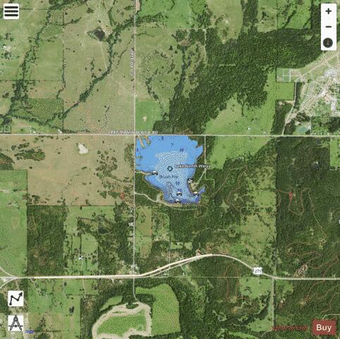
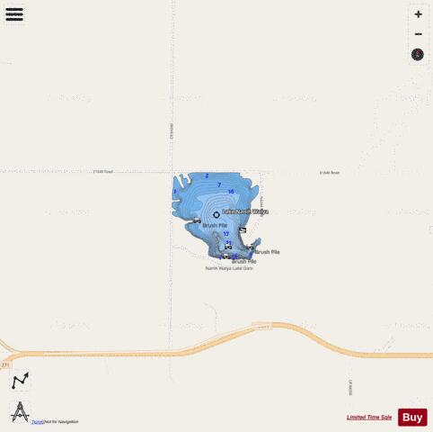
Nanih Waiya Lake is a small recreational lake in Pushmataha County, Oklahoma. It is in the Ouachita Mountains, 1.5 miles (2.4 km) northeast of Tuskahoma, Oklahoma, and 16.3 miles (26.2 km) from Talihina, Oklahoma. The lake, which was built in 1958, impounds the waters of several small creeks which are Kiamichi River tributaries. It was named for Nanih Waiya, the first capital of the Choctaw Nation after its removal during the Trail of Tears to Oklahoma, which is nearby. It is managed by the Oklahoma Department of Wildlife Conservation. Nanih Waiya Lake comprises 131 acres (0.53 km2) of area and 3 miles (4.8 km) of shoreline. Normal pool elevation is 594 foot (181 m) above sea level. Its normal holding capacity is 1,064 acre-feet (1,312,000 m3). The lake is popular for boating and fishing. There are two boat ramps, one on the southeast shore and one on the southwest shore. The area around the lake has sites for pitching tents. Hiking trails near the lake are: Clayton Trail, Cripple Mountain Trail, Five N Trail, Hurd Trail and Walters Mule Trail. The Choctaw Nation and the State of Oklahoma signed an agreement that allows the Choctaw Nation to buy at least 50,000 hunting and fishing licenses at $2.00 each for its resident citizens. The Choctaw Nation will also pay $200,000 and an administrative fee of $75,000 per year to the Oklahoma Department of Wildlife Conservation, which owns the lake. The Choctaw Nation will also take over maintenance of Lake Nanih Waiya. The agreement went into effect January 1, 2017 and ends December 31, 2019.
More on Wikipedia...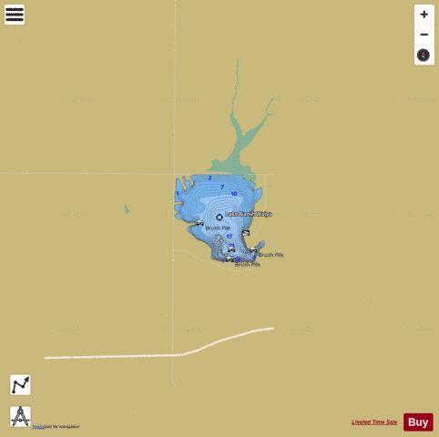
Lake Nanih Waiya Fishing Map Stats | |
| Title | Lake Nanih Waiya |
| Scale | 1:6000 |
| Counties | Pushmataha |
| Nearby Cities | Tuskahoma, Clayton, Yanush, Nashoba, Albion, Talihina, Wilburton, Weathers, Gowen, Honobia |
| Area * | 104.52 acres |
| Shoreline * | 2.42 miles |
| Min Longitude | -95.30 |
| Min Latitude | 34.63 |
| Max Longitude | -95.30 |
| Max Latitude | 34.64 |
| Edition Label 1 | |
| Edition Label 2 | |
| Edition Label 3 | |
| Id | US_OK_nanihwaiya |
| Country | US |
| Projection | Mercator |
| * some Stats may include nearby/connecting waterbodies | |
|