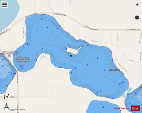
Middle Jefferson fishing map is available as part of iBoating : USA Marine & Fishing App(now supported on multiple platforms including Android, iPhone/iPad, MacBook, and Windows(tablet and phone)/PC based chartplotter.).
With our Lake Maps App, you get all the great marine chart app features like fishing spots, along with Middle Jefferson lake depth map. The fishing maps app include HD lake depth contours, along with advanced features found in Fish Finder / Gps Chart Plotter systems, turning your device into a Depth Finder. The Middle Jefferson Navigation App provides advanced features of a Marine Chartplotter including adjusting water level offset and custom depth shading. Fishing spots and depth contours layers are available in most Lake maps. Lake navigation features include advanced instrumentation to gather wind speed direction, water temperature, water depth, and accurate GPS with AIS receivers(using NMEA over TCP/UDP). Autopilot support can be enabled during ‘Goto WayPoint’ and ‘Route Assistance’.
Now i-Boating supports Fishing Points in Middle Jefferson.
Have more questions about the Nautical Chart App? Ask us.
Fishing Info for Middle Jefferson
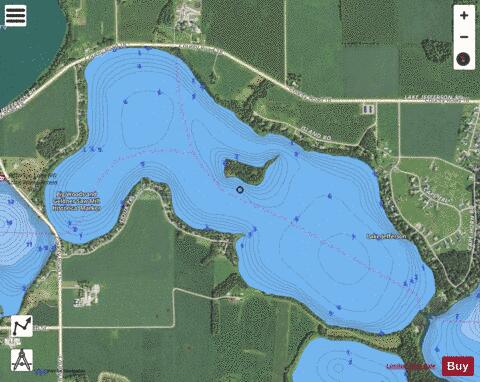
Lake Jefferson is a lake in Le Sueur County, Minnesota. The lake covers an area of 1,141 acres (4.62 km2) and is 37 feet (11 m) deep at its deepest point. Fish species enzootic to Lake Jefferson include bluegill, largemouth bass, northern pike, and walleye. While the Geographic Names Information System considers Lake Jefferson to be a single lake, it is sometimes referred to as two lakes, East Jefferson Lake and West Jefferson Lake. There are four sections: lower Jefferson, middle Jefferson, upper Jefferson, and Swedes Bay. The lake drains to German Lake through a connecting culvert, and is part of the Cannon River watershed. The lake was named for Thomas Jefferson, the third President of the United States.
More on Wikipedia...Popular fish species in this lake include Largemouth bass, Northern pike and Walleye.
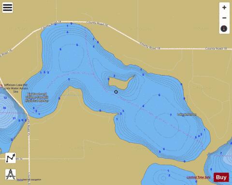
Middle Jefferson Fishing Map Stats | |
| Title | Middle Jefferson |
| Scale | 1:6000 |
| Counties | Le Sueur |
| Nearby Cities | Cleveland, Madison Lake, Le Center, Elysian, Eagle Lake, Saint Peter, Kasota, Janesville, Ottawa, Saint Clair |
| Area * | 655.41 acres |
| Shoreline * | 6.06 miles |
| Min Longitude | -93.81 |
| Min Latitude | 44.27 |
| Max Longitude | -93.77 |
| Max Latitude | 44.29 |
| Edition Label 1 | |
| Edition Label 2 | |
| Edition Label 3 | |
| Id | US_MN_40009204 |
| Country | US |
| Projection | Mercator |
| * some Stats may include nearby/connecting waterbodies | |
|