Long Lake fishing map is available as part of iBoating : USA Marine & Fishing App(now supported on multiple platforms including Android, iPhone/iPad, MacBook, and Windows(tablet and phone)/PC based chartplotter.).
With our Lake Maps App, you get all the great marine chart app features like fishing spots, along with Long Lake depth map. The fishing maps app include HD lake depth contours, along with advanced features found in Fish Finder / Gps Chart Plotter systems, turning your device into a Depth Finder. The Long Lake Navigation App provides advanced features of a Marine Chartplotter including adjusting water level offset and custom depth shading. Fishing spots and depth contours layers are available in most Lake maps. Lake navigation features include advanced instrumentation to gather wind speed direction, water temperature, water depth, and accurate GPS with AIS receivers(using NMEA over TCP/UDP). Autopilot support can be enabled during ‘Goto WayPoint’ and ‘Route Assistance’.
Now i-Boating supports Fishing Points in Long Lake.
Have more questions about the Nautical Chart App? Ask us.
Fishing Info for Long Lake
Long Lake is a fresh water lake located in southwest Kalkaska County in the U.S. state of Michigan. The lake encompasses 78 acres (31.6 ha). It is located entirely within Springfield Township about five miles (8.0 km) east of U.S. Highway 131 and Fife Lake. The lake has a maximum depth of 20 feet (6.1 m) near the northern end. The lake is surrounded mostly by private residences but does have one public access boat launch along Ingersoll Road at the southern end of the lake at 44°34′06.2″N 85°18′13.3″W / 44.568389°N 85.303694°W. The boat launch has minimal roadside parking with a loose gravel surface that is only suitable for small to medium watercraft.
More on Wikipedia...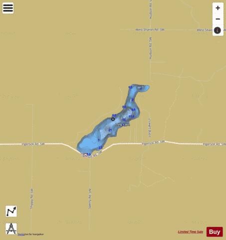
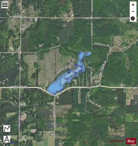
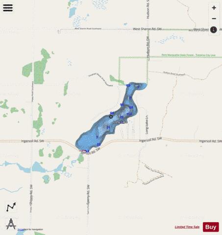
Long Lake Fishing Map Stats | |
| Title | Long Lake |
| Scale | 1:6000 |
| Includes Data from Fish Atlas | Yes |
| Counties | Kalkaska |
| Nearby Cities | Fife Lake, South Boardman, Manton, Kalkaska, Williamsburg, Kingsley, Jennings, Lake City, Rapid City, Haring |
| Area * | 66.83 acres |
| Shoreline * | 2.03 miles |
| Min Longitude | -85.31 |
| Min Latitude | 44.57 |
| Max Longitude | -85.29 |
| Max Latitude | 44.58 |
| Edition Label 1 | |
| Edition Label 2 | |
| Edition Label 3 | |
| Id | US_MI_40_16 |
| Country | US |
| Projection | Mercator |
| * some Stats may include nearby/connecting waterbodies | |
|