Cedar Hedge Lake fishing map is available as part of iBoating : USA Marine & Fishing App(now supported on multiple platforms including Android, iPhone/iPad, MacBook, and Windows(tablet and phone)/PC based chartplotter.).
With our Lake Maps App, you get all the great marine chart app features like fishing spots, along with Cedar Hedge Lake depth map. The fishing maps app include HD lake depth contours, along with advanced features found in Fish Finder / Gps Chart Plotter systems, turning your device into a Depth Finder. The Cedar Hedge Lake Navigation App provides advanced features of a Marine Chartplotter including adjusting water level offset and custom depth shading. Fishing spots and depth contours layers are available in most Lake maps. Lake navigation features include advanced instrumentation to gather wind speed direction, water temperature, water depth, and accurate GPS with AIS receivers(using NMEA over TCP/UDP). Autopilot support can be enabled during ‘Goto WayPoint’ and ‘Route Assistance’.
Now i-Boating supports Fishing Points in Cedar Hedge Lake.
Have more questions about the Nautical Chart App? Ask us.
Fishing Info for Cedar Hedge Lake
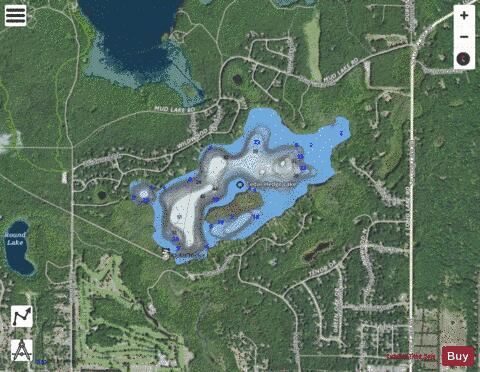
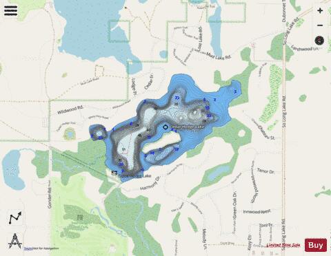
Cedar Hedge Lake is a medium-sized lake with a very sandy bottom. It is known for its large island, Cedar Hedge Island in the southern area of the lake. The lake is completely within Green Lake Township, Grand Traverse County, Michigan. The Tullers River flows out of the lake and into nearby Green Lake. Then, water flows into the Betsie River and out to Lake Michigan
More on Wikipedia...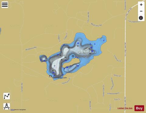
Cedar Hedge Lake Fishing Map Stats | |
| Title | Cedar Hedge Lake |
| Scale | 1:6000 |
| Includes Data from Fish Atlas | Yes |
| Counties | Grand Traverse |
| Nearby Cities | Interlochen, Bendon, Lake Ann, Grawn, Chums Corner, Nessen City, Cedar, Greilickville, Traverse City, Buckley |
| Area * | 192.34 acres |
| Shoreline * | 3.62 miles |
| Min Longitude | -85.79 |
| Min Latitude | 44.67 |
| Max Longitude | -85.77 |
| Max Latitude | 44.68 |
| Edition Label 1 | |
| Edition Label 2 | |
| Edition Label 3 | |
| Id | US_MI_28_110 |
| Country | US |
| Projection | Mercator |
| * some Stats may include nearby/connecting waterbodies | |
|