Crooked Lake fishing map is available as part of iBoating : USA Marine & Fishing App(now supported on multiple platforms including Android, iPhone/iPad, MacBook, and Windows(tablet and phone)/PC based chartplotter.).
With our Lake Maps App, you get all the great marine chart app features like fishing spots, along with Crooked Lake depth map. The fishing maps app include HD lake depth contours, along with advanced features found in Fish Finder / Gps Chart Plotter systems, turning your device into a Depth Finder. The Crooked Lake Navigation App provides advanced features of a Marine Chartplotter including adjusting water level offset and custom depth shading. Fishing spots and depth contours layers are available in most Lake maps. Lake navigation features include advanced instrumentation to gather wind speed direction, water temperature, water depth, and accurate GPS with AIS receivers(using NMEA over TCP/UDP). Autopilot support can be enabled during ‘Goto WayPoint’ and ‘Route Assistance’.
Now i-Boating supports Fishing Points in Crooked Lake.
Have more questions about the Nautical Chart App? Ask us.
Fishing Info for Crooked Lake
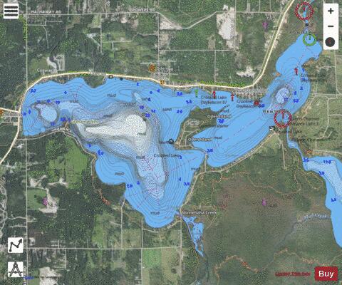
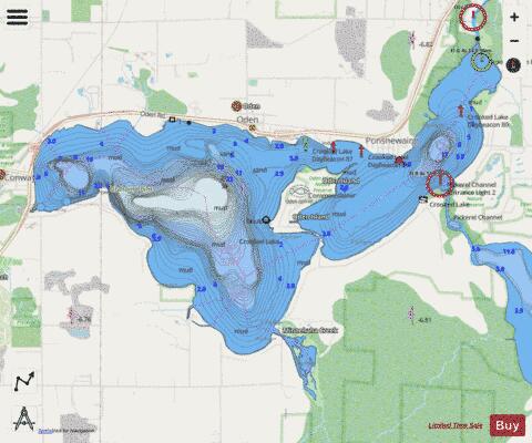
Crooked Lake is a lake that feeds the Crooked River. Located within Emmet County in the U.S. state of Michigan, it is the southwesternmost point of the recreational Inland Waterway. This watercourse uses locks to connect Crooked Lake with Lake Huron at Cheboygan. The discharge of water from Crooked Lake is controlled by the Alanson Waterway Locks located near Alanson, Michigan. The lake is a remnant of the postglacial Lake Nipissing. Its convoluted shape is the outcome of the glacier-cut topography through which its water drains, which includes lateral moraines, recessional moraines, and at least one kettle gouged by melting ice. Three small lakeside communities, Conway, Oden, and Ponshewaing, reflect the historic operations of depots of the Grand Rapids and Indiana Railroad that once brought residents and visitors to and from the lake. Today the north shore of the lake is served by U.S. Highway 31, and a continuous strip of development joins together the road and lake.
More on Wikipedia...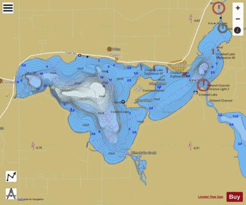
Crooked Lake Fishing Map Stats | |
| Title | Crooked Lake |
| Sailing Clubs in this Chart region | |
| Crooked Lake Yacht Club | |
| Scale | 1:24000 |
| Includes Data from Fish Atlas | Yes |
| Counties | Emmet |
| Nearby Cities | Oden, Ponshewaing, Conway, Alanson, Brutus, Bay View, Petoskey, Pellston, Harbor Springs, Walloon Lake |
| Area * | 2353.01 acres |
| Shoreline * | 18.70 miles |
| Min Longitude | -84.87 |
| Min Latitude | 45.39 |
| Max Longitude | -84.78 |
| Max Latitude | 45.43 |
| Edition Label 1 | |
| Edition Label 2 | |
| Edition Label 3 | |
| Id | US_MI_24_27 |
| Country | US |
| Projection | Mercator |
| * some Stats may include nearby/connecting waterbodies | |
|