Upper Lead Mountain Pond fishing map is available as part of iBoating : USA Marine & Fishing App(now supported on multiple platforms including Android, iPhone/iPad, MacBook, and Windows(tablet and phone)/PC based chartplotter.).
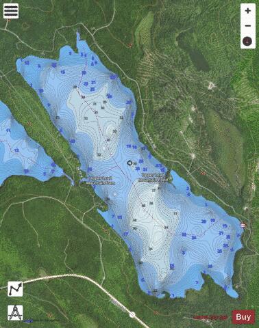
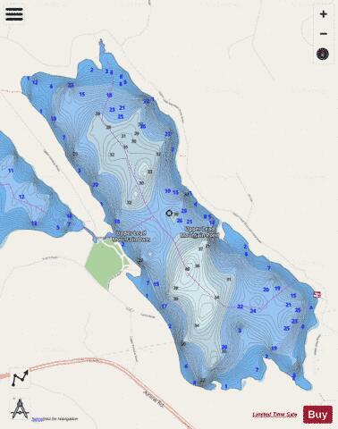
With our Lake Maps App, you get all the great marine chart app features like fishing spots, along with Upper Lead Mountain Pond depth map. The fishing maps app include HD lake depth contours, along with advanced features found in Fish Finder / Gps Chart Plotter systems, turning your device into a Depth Finder. The Upper Lead Mountain Pond Navigation App provides advanced features of a Marine Chartplotter including adjusting water level offset and custom depth shading. Fishing spots and depth contours layers are available in most Lake maps. Lake navigation features include advanced instrumentation to gather wind speed direction, water temperature, water depth, and accurate GPS with AIS receivers(using NMEA over TCP/UDP). Autopilot support can be enabled during ‘Goto WayPoint’ and ‘Route Assistance’.
Now i-Boating supports Fishing Points in Upper Lead Mountain Pond.
Have more questions about the Nautical Chart App? Ask us.
Fishing Info for Upper Lead Mountain Pond
Upper Lead Mountain Pond is a lake in Hancock County, Maine, United States. It is located less than 1.5 miles (2.4 km) west of the Lead Mountain and 0.25 mi (0.40 km) north of Maine State Route 9 near the town of Beddington. The inflow to Bear Pond comes from several small stream, and it drains via a small 500 feet (150 m) stream to Middle/Lower Lead Mountain Pond. Several unpaved roads provide access to the lake and private residences surrounding it. The Lake is surrounded by forest and supports several fish, including landlocked Atlantic salmon, brook trout, white perch, yellow perch, and chain pickerel.
More on Wikipedia...Popular fish species in this lake include Atlantic salmon, Brook trout, Chain pickerel and Yellow perch.
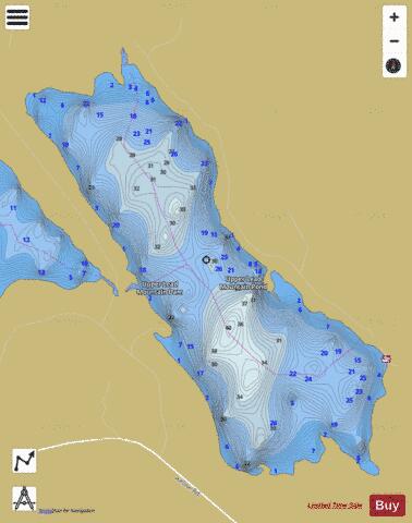
Upper Lead Mountain Pond Fishing Map Stats | |
| Title | Upper Lead Mountain Pond |
| Scale | 1:6000 |
| Counties | Hancock |
| Nearby Cities | Beddington, Great Pond, Deblois, Aurora, Eastbrook, Amherst, Waltham, Franklin, Mariaville, Cherryfield |
| Area * | 977.70 acres |
| Shoreline * | 8.07 miles |
| Min Longitude | -68.16 |
| Min Latitude | 44.84 |
| Max Longitude | -68.12 |
| Max Latitude | 44.87 |
| Edition Label 1 | |
| Edition Label 2 | |
| Edition Label 3 | |
| Id | US_ME_00577623 |
| Country | US |
| Projection | Mercator |
| * some Stats may include nearby/connecting waterbodies | |
|