Everett Lake fishing map is available as part of iBoating : USA Marine & Fishing App(now supported on multiple platforms including Android, iPhone/iPad, MacBook, and Windows(tablet and phone)/PC based chartplotter.).
With our Lake Maps App, you get all the great marine chart app features like fishing spots, along with Everett Lake depth map. The fishing maps app include HD lake depth contours, along with advanced features found in Fish Finder / Gps Chart Plotter systems, turning your device into a Depth Finder. The Everett Lake Navigation App provides advanced features of a Marine Chartplotter including adjusting water level offset and custom depth shading. Fishing spots and depth contours layers are available in most Lake maps. Lake navigation features include advanced instrumentation to gather wind speed direction, water temperature, water depth, and accurate GPS with AIS receivers(using NMEA over TCP/UDP). Autopilot support can be enabled during ‘Goto WayPoint’ and ‘Route Assistance’.
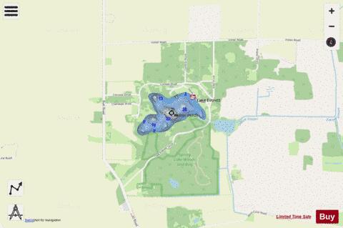
Now i-Boating supports Fishing Points in Everett Lake.
Have more questions about the Nautical Chart App? Ask us.
Fishing Info for Everett Lake
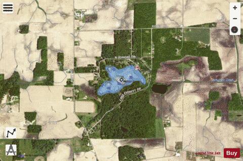
Lake Everett is a lake in Allen County, Indiana. The lake is about 42 acres and most of the land surrounding it is privately owned. Several small and a few larger cottages(some recently built) are located on the lake proper. The Indiana DNR maintains a beach, dock, and boat ramp on the lake. Lake Everett is held to be one of the area's best pan fishing locations. The lake is roughly twelve miles from Fort Wayne, Indiana with its major shopping and business center in NE Indiana. Fort Wayne has a hub airport(Baer Field) with national & international service available, and a general aviation airport(Smith Field). Both are located in or at The Fort Wayne city limits. Baer Field also houses the Indiana air National Guard's local squadron Currently flying A-10 Warthogs and to be modernized in coming years. Lake Everett was named for Charles Everett, an early landowner.
More on Wikipedia...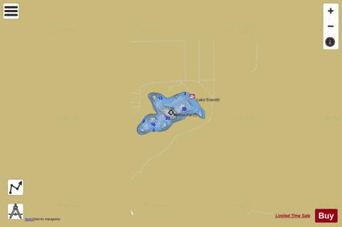
Everett Lake Fishing Map Stats | |
| Title | Everett Lake |
| Scale | 1:1500 |
| Counties | Allen |
| Nearby Cities | Arcola, Churubusco, Aboite, Tri-Lakes, Huntertown, Laud, Columbia City, Merriam, Laotto, Fort Wayne |
| Area * | 43.35 acres |
| Shoreline * | 1.34 miles |
| Min Longitude | -85.32 |
| Min Latitude | 41.15 |
| Max Longitude | -85.31 |
| Max Latitude | 41.16 |
| Edition Label 1 | |
| Edition Label 2 | |
| Edition Label 3 | |
| Id | US_IN_00434263 |
| Country | US |
| Projection | Mercator |
| * some Stats may include nearby/connecting waterbodies | |
|