ORANGE LAKE fishing map is available as part of iBoating : USA Marine & Fishing App(now supported on multiple platforms including Android, iPhone/iPad, MacBook, and Windows(tablet and phone)/PC based chartplotter.).
With our Lake Maps App, you get all the great marine chart app features like fishing spots, along with ORANGE LAKE depth map. The fishing maps app include HD lake depth contours, along with advanced features found in Fish Finder / Gps Chart Plotter systems, turning your device into a Depth Finder. The ORANGE LAKE Navigation App provides advanced features of a Marine Chartplotter including adjusting water level offset and custom depth shading. Fishing spots and depth contours layers are available in most Lake maps. Lake navigation features include advanced instrumentation to gather wind speed direction, water temperature, water depth, and accurate GPS with AIS receivers(using NMEA over TCP/UDP). Autopilot support can be enabled during ‘Goto WayPoint’ and ‘Route Assistance’.
Now i-Boating supports Fishing Points in ORANGE LAKE.
Have more questions about the Nautical Chart App? Ask us.
Fishing Info for ORANGE LAKE
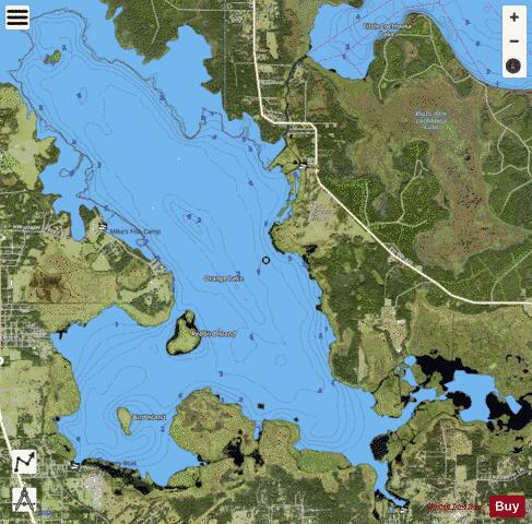
Orange Lake is in Alachua County, Florida, about 10 miles (16 km) south of Hawthorne. It has an area of about 12,550 acres (5,080 ha), and is part of the Orange Creek Basin, which is in turn part of the Oklawaha River watershed. Cross Creek flows into it from Lochloosa Lake, and Orange Creek drains it into the Rodman Reservoir. Orange Lake also receives water from Newnans Lake that has been diverted from its historic destination of Paynes Prairie. Orange Lake is noted for fishing, especially bass, with many fishing camps on its shores. The lake also has many natural floating islands, which have an "unusually high diversity", especially of amphibians. The Timucua village of Potano was located along the western shore of Orange Lake in 1539, when it was visited by the Hernando de Soto expedition. The town of Potano was moved to a site northwest of present-day Gainesville, Florida in 1584 after being burned by the Spanish. The Spanish Mission of San Buenaventura de Potano was established at the old site of the town by or before 1608. Remains of the town and the foundation of the mission church were discovered at the Richardson Site, 8AL100, in 2013. The lake was named for its location in a citrus-growing district.
More on Wikipedia...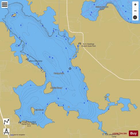
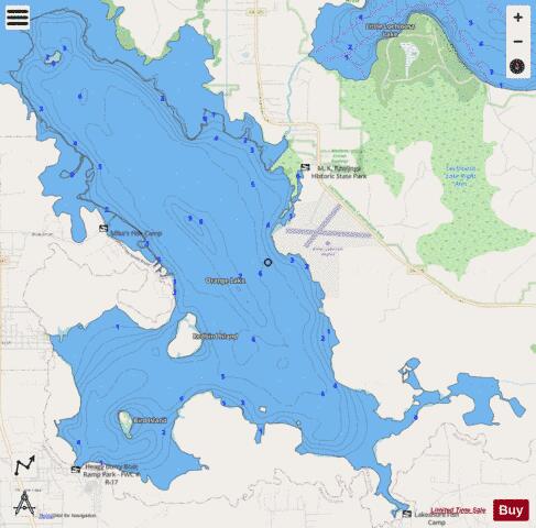
ORANGE LAKE Fishing Map Stats | |
| Title | ORANGE LAKE |
| Scale | 1:12000 |
| 1 ft Depth Contours for Anglers | Yes |
| Counties | Alachua, Marion |
| Nearby Cities | McIntosh, Orange Lake, Island Grove, Citra, Reddick, Micanopy, Lochloosa, Sparr, Rochelle, Lowell |
| Area * | 7277.93 acres |
| Shoreline * | 45.72 miles |
| Min Longitude | -82.22 |
| Min Latitude | 29.42 |
| Max Longitude | -82.12 |
| Max Latitude | 29.51 |
| Edition Label 1 | |
| Edition Label 2 | |
| Edition Label 3 | |
| Id | US_FL_00288216 |
| Country | US |
| Projection | Mercator |
| * some Stats may include nearby/connecting waterbodies | |
|