Spednic Lake fishing map is available as part of iBoating : USA Marine & Fishing App(now supported on multiple platforms including Android, iPhone/iPad, MacBook, and Windows(tablet and phone)/PC based chartplotter.).
With our Lake Maps App, you get all the great marine chart app features like fishing spots, along with Spednic Lake depth map. The fishing maps app include HD lake depth contours, along with advanced features found in Fish Finder / Gps Chart Plotter systems, turning your device into a Depth Finder. The Spednic Lake Navigation App provides advanced features of a Marine Chartplotter including adjusting water level offset and custom depth shading. Fishing spots and depth contours layers are available in most Lake maps. Lake navigation features include advanced instrumentation to gather wind speed direction, water temperature, water depth, and accurate GPS with AIS receivers(using NMEA over TCP/UDP). Autopilot support can be enabled during ‘Goto WayPoint’ and ‘Route Assistance’.
Now i-Boating supports Fishing Points in Spednic Lake.
Have more questions about the Nautical Chart App? Ask us.
Fishing Info for Spednic Lake
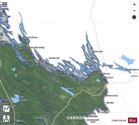
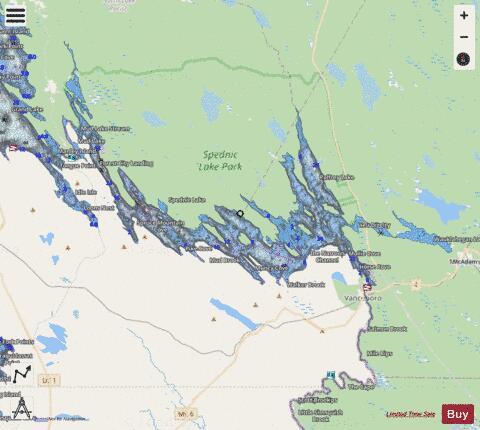
Spednic Lake (sometimes Spednik Lake or Spednick Lake) is a mesotrophic lake in the Chiputneticook Lakes chain along the Canada–United States border between the state of Maine and the province of New Brunswick that is best known for its bass fishing. Sometimes it is viewed as the headwaters of the St. Croix River, sometimes a lake further up the chain is considered the headwaters. The international border runs through the lake. A northeastern arm of the lake, located entirely in Canada, retains the name Palfrey Lake. Prior to dam construction that expanded Spednic Lake they were separate lakes, but now they are hydrologically and ecologically a single combined lake. The first dam at the outlet of the lake was constructed in 1836 with a 15-foot (4.6 m) impoundment level. Over the years the dam has been modified and is now known as the . Waterflow from this dam and others upstream are regulated by the International St. Croix River Board that is appointed by the International Joint Commission between the United States and Canada. The lake shores are primarily undeveloped, and held in conservation or protected status, either through land ownership or easement, by the state of Maine and the province of New Brunswick. Small portions remain in private hands. The principal access in Maine is via a public boat launch in the town of Vanceboro. Canoes can also be portaged from elsewhere in the watershed.
More on Wikipedia...Popular fish species in this lake include American eel, American shad, Brown bullhead, Burbot, Chain pickerel, Common shiner, Fallfish, Golden shiner, Lake whitefish, Pumpkinseed, Rainbow smelt, Semotilus atromaculatus, Smallmouth bass, White sucker and Yellow perch.
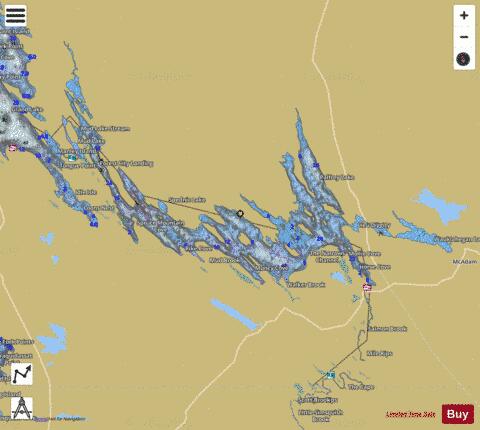
Spednic Lake Fishing Map Stats | |
| Title | Spednic Lake |
| Scale | 1:12000 |
| Counties | Washington |
| Nearby Cities | Vanceboro, Danforth, Weston, Brookton, Orient, Topsfield, North Amity, Haynesville, Bancroft, Waite |
| Area * | 19734.59 acres |
| Shoreline * | 223.64 miles |
| Min Longitude | -67.77 |
| Min Latitude | 45.50 |
| Max Longitude | -67.34 |
| Max Latitude | 45.75 |
| Edition Label 1 | |
| Edition Label 2 | |
| Edition Label 3 | |
| Id | US_CC_ME_spednic_lake_spl_me |
| Country | US |
| Projection | Mercator |
| * some Stats may include nearby/connecting waterbodies | |
|