Wachusett Reservoir fishing map is available as part of iBoating : USA Marine & Fishing App(now supported on multiple platforms including Android, iPhone/iPad, MacBook, and Windows(tablet and phone)/PC based chartplotter.).
With our Lake Maps App, you get all the great marine chart app features like fishing spots, along with Wachusett Reservoir depth map. The fishing maps app include HD lake depth contours, along with advanced features found in Fish Finder / Gps Chart Plotter systems, turning your device into a Depth Finder. The Wachusett Reservoir Navigation App provides advanced features of a Marine Chartplotter including adjusting water level offset and custom depth shading. Fishing spots and depth contours layers are available in most Lake maps. Lake navigation features include advanced instrumentation to gather wind speed direction, water temperature, water depth, and accurate GPS with AIS receivers(using NMEA over TCP/UDP). Autopilot support can be enabled during ‘Goto WayPoint’ and ‘Route Assistance’.
Now i-Boating supports Fishing Points in Wachusett Reservoir.
Have more questions about the Nautical Chart App? Ask us.
Fishing Info for Wachusett Reservoir
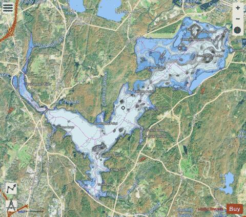
The Wachusett Reservoir is the second largest body of water in the state of Massachusetts. It is located in central Massachusetts, northeast of Worcester. It is part of the water supply system for metropolitan Boston maintained by the Massachusetts Water Resources Authority (MWRA). It has an aggregate capacity of 65 billion US gallons (250,000,000 m3) and an area of almost 7 square miles (18 km2). Water from the reservoir flows to the covered via the Cosgrove Tunnel and the MetroWest Water Supply Tunnel. The reservoir has a maximum depth of 120 feet (37 m) and a mean depth of 48 feet (15 m). The reservoir serves as both an intermediate storage reservoir for water from the Quabbin Reservoir, and a water source itself, fed by its own watershed. The reservoir is fed by the Quinapoxet and Stillwater rivers, along with the Quabbin Aqueduct, which carries water from the Quabbin Reservoir. It is part of the Nashua River watershed, forming the headwaters of the river. Because it is an intermediate storage reservoir, its water levels are kept relatively constant while the Quabbin Reservoir fluctuates based on precipitation and demand. At times when the Wachusett Reservoir becomes high due to its own watershed producing a large amount of runoff such as during snow melting, the flow from the Quabbin is shut off and water from the Ware River flows backwards down the Quabbin Aqueduct into the Quabbin Reservoir for storage.
More on Wikipedia...Popular fish species in this lake include Atlantic salmon, Lake trout and Smallmouth bass.
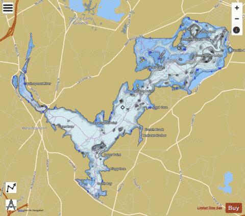
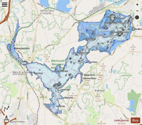
Wachusett Reservoir Fishing Map Stats | |
| Title | Wachusett Reservoir |
| Scale | 1:12000 |
| Counties | Worcester |
| Nearby Cities | West Boylston, Clinton, South Lancaster, Sterling, Berlin, Lancaster, Shrewsbury, Holden, Bolton, Northborough |
| Area * | 3966.93 acres |
| Shoreline * | 38.13 miles |
| Min Longitude | -71.80 |
| Min Latitude | 42.34 |
| Max Longitude | -71.68 |
| Max Latitude | 42.41 |
| Edition Label 1 | |
| Edition Label 2 | |
| Edition Label 3 | |
| Id | US_CC_MA_617452 |
| Country | US |
| Projection | Mercator |
| * some Stats may include nearby/connecting waterbodies | |
|